
Where am I going?
Highlight Hiker Blog
Allaire State Park
October 11, 2020
On an overcast, drizzly but warm day, I dropped off my son and his best friend at Six Flags Great Adventure amusement park and while they had their fun, I had mine at Allaire State Park. Well, technically it was four hours worth of fun. Then the park closed and I had to sit in my car in the parking lot at the amusement park until the boys had had their fill. BUT I DIGRESS….
This photo journal is pretty big, but I figured this might be the only time I visit Allaire SP so I crammed in as much as I could in the time I had. It ended up my visitation of two trails and a walk around the campground, stopping to admire the train, having a little snack break at the car, and then meandering around the village in the last half hour before closing.
What I can tell you is that hiking in the Coastal Plains is very different from hiking in the Appalachian region. For one, coastal plains are flat, hard packed clay with a dusting of sand; trails are wide and very well traveled. In other words: kinda’ boring. But, my pace was ah-maz-ing as a result and so I covered over 7 miles in about 3 - 3.5 hours. You’ll get a kick out of this… my total elevation gain was 125’!!! THAT’S RIGHT! Laughable. But, again… my pace was crazy fast as a result, even with all the photo stops.
The park is incredibly crowded but despite that it is delightful. It would be worth exploring more, and I’m especially interested in exploring the orange trail that runs along the abandoned Freehold -Jamesburg Railroad. When you see the one photo I capped, you’ll see why. It’s picture perfect in the fall. And winter. And spring. And summer.
The family campground is very nice and while I was hiking around I decided that it would make a great home base the next time I drop the boys off for another day of fun at the park. Grab a book, build a campfire, enjoy the facilities at my leisure. Basically your perfect place to hunker down for a long day.
The Historic Allaire Village offers more history than I was able to absorb in the short amount of time I was there. The website is chock full of knowledge for the curious and offers a glimpse into what formed this region both geologically as well as historically. And did I mention there is a kick ass gift shop???
Now kick back, relax and enjoy the easy walk through the photo gallery. There is a lot more information about my visit in detail there.
PS. The explore it button is for the historic village at Allaire because it’s a much better website than the state website. Seriously… NJ needs to invest a little more money into their parks. The website is outdated and not very user friendly. But then again… if it was, you wouldn’t need me, now would ya’??? BUT I DIGRESS. Check it out… you’ll see the difference.

The Chapel is just as pretty on the inside as it is on the outside. The chapel was also used as the village school.

Fun fact: the Allaire Chapel was built in two sections, which is why the bell tower is at the back of the building instead of the front. It is one of a kind and no other churches are constructed this way.

Here is a map of the trails... it's very basic, but it's all you need on these wide and well traveled trails. I hiked on the green & red trails, through the campground and throughout the village.

Trail head for the green trail. Y'know... I didn't take a picture of the parking lot for you, but don't worry... it can hold more than 200 cars, I think. It has two sections, and there is yet another small parking lot located at the Nature Center.

The green trail goes in two different directions from the trail head.

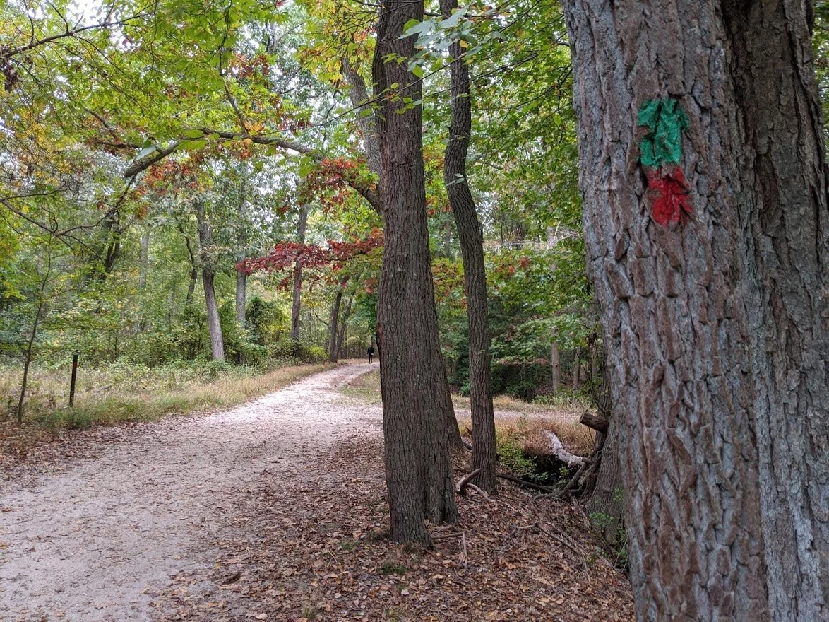
Wide, sandy trails with zero elevation. For miles. And miles. And... =yawn=... miles.

But the fall colors made the flat and boring extraordinary.

The map didn't include names of significant places you pass by, so I have no idea what this little pond is called, but it's right by the Nature Center.

Trail head for the red. I would walk this trail on my return trip.

For miles... and miles...

This bridge connected the green/red trails to the Nature Center.

Cute little creek.

A nice place to sit a spell on the way to the nature trail. This park had all kinds of places for R&R from picnic grounds to benches.
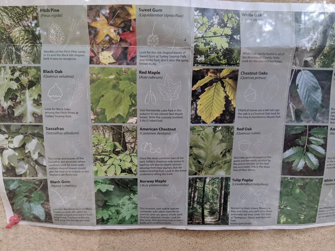
Here's a little nature name game at the Nature Center Welcome kiosk.

The Welcome kiosks at the Nature Center
The Nature Center was closed. Not sure if it was closed for the season, or because of covid, but it was closed.

SMOKEY!!! You're my dude!

There was a nice old bridge that led to the Nature Center parking lot.

The nameless pond from the bridge.
Back to the green & red blazes

Gorgeous fall day amid the endless flat miles of trails.

Just another nameless pond.

The red trail veers off, and the green trail passes under highway 195.

This was my zombie apocalypse moment.

It felt utterly desolate. I had to look over my shoulder to make sure that the walking dead weren't behind me! LOL

Totally alive and back to miles of flat sandy trail. I had to cross Allaire Rod #524. Just... not here.

Here. Closer to the campground entrance.

This pond isn't even ON the map, but it was much larger than the one by the Nature Center. Clearly there is marshland all over this specific part of the park.

A little less traveled on the campground end of the green trail... I didn't see a single person over here. Which really DID make it feel zombie apocalypse-y!

You know what I always say? 'When in doubt, go right!"

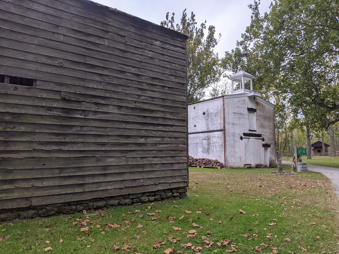
I couldn't make out why these pallets were here and to what purpose someone would bring them to this place, but here they are nonetheless!

There were no rocks on the trail, no boulder fields or rock scrambles and I had to keep reminding myself to LOOK UP. It was kinda' cool to feel confident enough in the terrain that I could look up and walk at the same time.

So maybe this flat sandy trail for miles and miles isn't so bad... Oh wait! I'm already at the orange trail?

Check this out: this is the abandoned Freehold-Jamesburg RR. Isn't that amazing? Next time, I'm taking THIS trail!

Such cool history in this entire area. I would love to know more.

Finally - single track at the back end of the green trail. This is more like what I'm used to!

The trail was grown over with Coastal Sweet Pepperbush.

This was my favorite place on the green trail - secluded, a little obstacle and the green tunnel of a trail that went on forever ahead of you.

You could just peek through the trees to see the marshland. But if you're a GOT fan, you might notice a tree that is a lot like the Godswood of Winterfell.

Can you see it there? It's like the Stark Family Tree, no?

Headed back toward the campground. I respected the privacy of the campers and did not take photos of the campground itself.

Past the street crossing, and the highway overpass, and back to the red blaze trail head.

The red trail was pretty with long views of lush green fields, despite the dryness of the weather and soil. This was all of the Mingemahone Brook that I saw.

Isn't that interesting? Too bad the interpretative sign was too high for anyone to read. Seriously, it was over 6' high. Who made that decision???

A short (warped) boardwalk takes you through a peat bog.

I'm guessing this is winterberry...???

Giant ferns dotted the peat bog.

OH MY GOSH! ELEVATION!!!

Meanwhile, back at the nameless pond at the nature center...

Wide sandy trail

Back by the parking lot and Village entrance there is an enormous picnic area.
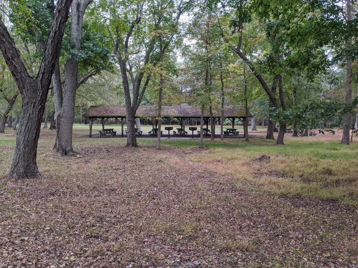
Most of the picnic tables are not covered, but there was this one covered area.

The Welcome Center for Allaire Village is closed for construction.

At the Pine Creek Railroad

After a long day of hauling guests on the circular track, the engine deserves a little night-night in the round house.

Pine Creek Railroad

The Manasaquan Bikeway begins here. I didn't have the right kind of footgear for pavement walking, so I didn't explore much of this trail.

Back at the Chapel on the way to the Village.

There is a $5 fee to enter the Village, but at 5:30 pm, no one was collecting it. The commercial photographers were out en force in these later hours. I passed 5 groups having professional portraits taken on the grounds.

The blacksmith building is in the background.

The bakery is open frequently, though it was closed when I arrived. The baked goods looked marvelous through the window!

Every corner of the village has a nice view.
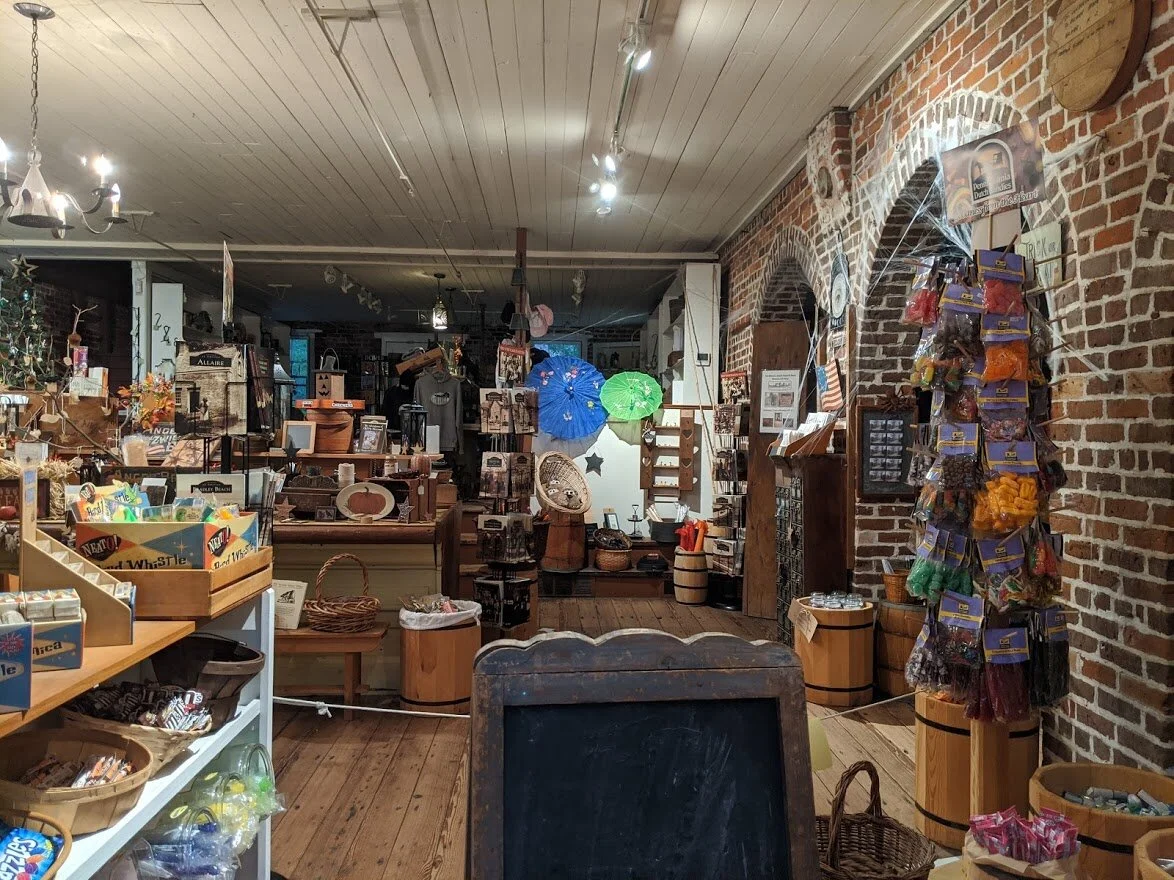
The General Store is right up my alley!!! I LOVE GIFT SHOPS! I was really disappointed that I came to the building after it had closed.

The General Store

My photos of the enameling building and carpenters house were blurry. But I managed to stop long enough to capture this one!

The carriage house and barn

The Allaire house. Yes. There was an Allaire family and they established the village.

And they had a really nice house.

The back of the house. The view was great, but the picture I took didn't translate well.

Mr. Allaire had a pig iron furnace here. My historical knowledge of pig iron goes back to Fayette State Park in the UP of Michigan, which was my favorite place to camp in my 20's. Allaire village wasn't as big as Fayette, nor was it as rough. Living here was definitely more civilzed.

The top blast furnace

But you had to walk down a hill (ELEVATION!) to get to the bottom of the blast furnace

The entire blast furnace.

The crucible. Not the play, the actual crucible.

On my way back to the village, I found this...!!!

Nothing better than coming across a little single track, amiright???

The Manasquan River flows here and was used to power the mill.