

Where am I going?
Highlight Hiker Blog
March 22, 2021
Norvin Green State Forest
Lake Sonoma Trail
Don’t you love it when you’re on a trail, and come across unexpected manmade treasures from an era long past? You walk away curious and wondering, ‘Who lived there?’ ‘What use did that have?’ It sparks the imagination and you think about what it was like to survive in a time when these woods weren’t surrounded by our modern conveniences which we escape to when we’re finished frolicking in the forest.
I’m still researching a few such spots. Thanks to covid, I haven’t been able to get into the historical society, library or Long Pond Ironworks museum to ask questions when my internet searches peter out. But high on my list are the old stone walls found on Dunker Pond Trail in Newark-Pequannock Watershed, and another located here, along the new Lake Sonoma trail.
But let me first talk about the trail itself. Between 2020 and 2022 there are many changes and the addition of a new trail (currently under construction) in this section of Norvin Green State Forest. As you all know, I prefer paper maps, and my last print of this map is from 2017, so the Lake Sonoma trail does not appear at all on it. It wasn’t until I arrived at the Lake Manaticut entrance on Crescent Road that I found an updated version of the map which included these trail. Originally I was just going to hike the Mananticut loop, but I c’mon! I can’t resist a new trail! You want to see the new blaze, and I’m going to give it to you!
So I took a picture of the new map and headed out with both maps to guide me.
I’m guessing that this trail was in existence before: either by way of an old blaze, or by the winding twisting unmarked paths you can find just about anywhere in this park. And just a PSA: don’t follow a trail without a blaze without a map and compass and/or GPS. You will get lost in this parks 5,426 acres. I’m making an educated guess about this, but from my research, it appears that Norvin Green has the highest number of lost & injured hiker rescues than any other state land in northern NJ. The terrain throughout the forest is a mixed bag, ranging from easy to difficult. The Manaticut section is rated difficult. I felt that the Lake Sonoma portion was moderate in some sections and easy in others, though there are several small pud’s (pud = pointless ups and downs). However, the Lake Sonoma trail, in my opinion, offers greater rewards than the Manaticut loop trail + Overlook Rock trails combined.
In any case, you’ll need a picture of the new route before you head out. Most of the new blaze is really well marked, with one small exception. Once you’ve passed Lake Sonoma and the fireplace, the trail goes from single track to an old woods road. This section is not properly marked, and I have a photo to show you. The blazes clearly tell you to turn left AFTER you’ve already turned and supposed to go straight up the hill on the road. There are no visible blazes in any direction for quite some time after this to let you know you’re on the right track going up the hill. The map I had was not detailed with woods road markings or land contours to decipher which direction to go. The animal path to the left (which I could see led to nowhere), the woods road, or if there was some other path I was missing. I just followed the woods road and hoped for the best. If I could encourage the NY/NJ Trail Conference to modify blazes, I would encourage them to do it here.
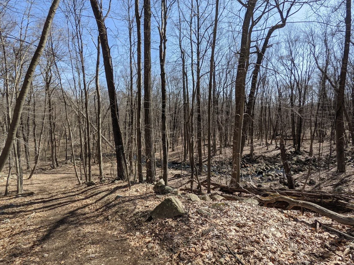
The rest of the trail was delightful. Filled with scenic viewpoints, tens of brook crossings, woods roads, single track, double track, and steep challenging climbs. Bonus: there is evidence of human occupation from over 100 years ago just chillin’ along the trail.
My only complaint about this loop is the trash all along the rough “closed road” section of Burnt Meadow Road. You go from pristine wilderness to a dumping ground. Which is pretty pathetic, if you ask me. There are resources to properly dispose of your junk nearby. Don’t drop off your wooden pallets, hoses, empty paint cans, broken bins and mini fridge here. I mean… it’s the worst dumping site on trail I have ever seen.
I’m sure this trail is lovely and cool under a shaded, woodsy ceiling but honestly, I think the best time to visit is early spring before the trees flush. You’ll be able to see more, hear the frogs, cross the rushing brooks, and not have to search in underbrush to find remnants of human history.
It may not have the high vistas and waterfalls of the other trails in Norvin Green, but the Lake Sonoma Trail has a boon of charm that some of the others in the vicinity lack.
Norvin Green State Forest
Lake Sonoma Trail
Total Mileage:
6.06 miles
Total Elevation:
1,083 feet

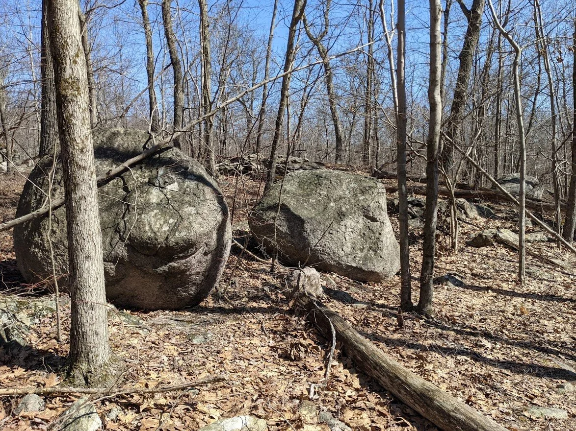
I love the large rock at the Crescent Road entrance.

There is roadside parking a'plenty on Crescent Road, even on the weekends.

This was the first photo of the new map that I had, but I found a better one along the way. If you're going to try the Lake Sonoma Trail, use the other photo.

The kiosk at Crescent Road has updated information. The spur trail here is about .25 mile and from there you can choose your own adventure.

You cross over countless brooks on this trail right from the beginning on the spur trail.

Not sure why those are there, but there they are!

There is a long brook that sprawls throughout the beginning of this hike, but it isn't drawn on my 2017 map and has no name. Which baffles me, because it's a large brook!

The rocky terrain of the spur trail shows you what is in store. It never deviates from this, it just gets a little easier in some sections. Wear sturdy shoes!

There is a waterfall in the shadow of these rocks, believe it or not! There are two brook crossing one after the other here, but I don't know that they are reliable in drier seasons.

Two brook crossings one right after another, but they are easily rock hopped.

Here is where the spur trail meets it's end. From here you can go left to Manaticut Point, or right to go to Lake Sonoma.

I went left.

You'll follow along this unnamed brook for a very long time, and can listen tot he babbling and rushing of various sized waterfalls.

The unnamed brook gets wider, the farther up the trail you go.

Looking back, the sun glistens on the water.

I am in love with the geology of this area. I wish I studied geology more in college.
BE MORE ERRATIC!

Here a rock, there a rock, everywhere a rock, rock. Lake Sonoma's trails have rocks. Ee yai, ee yai, yo!

They are so tall and commanding, just plunked here on the side of the trail. If you aren't climbing rock, you're weaving in and out of rock.

The midday shadows are lovely.

When I reached the first Lake Sonoma trail head (orange blaze), I found this incredibly helpful map! PS. I didn't turn onto the trail here. I followed the Manaticut loop (yellow blaze) past Lake Sonoma to the westernmost trail head.

The map only lists one viewpoint for Lake Sonoma, but when the trees are bare, the entire walk around it's western shore is a scenic view!

The yellow and orange trails meet and walk together for some distance around the western shore of the lake. See the rowboat on the right hand side?

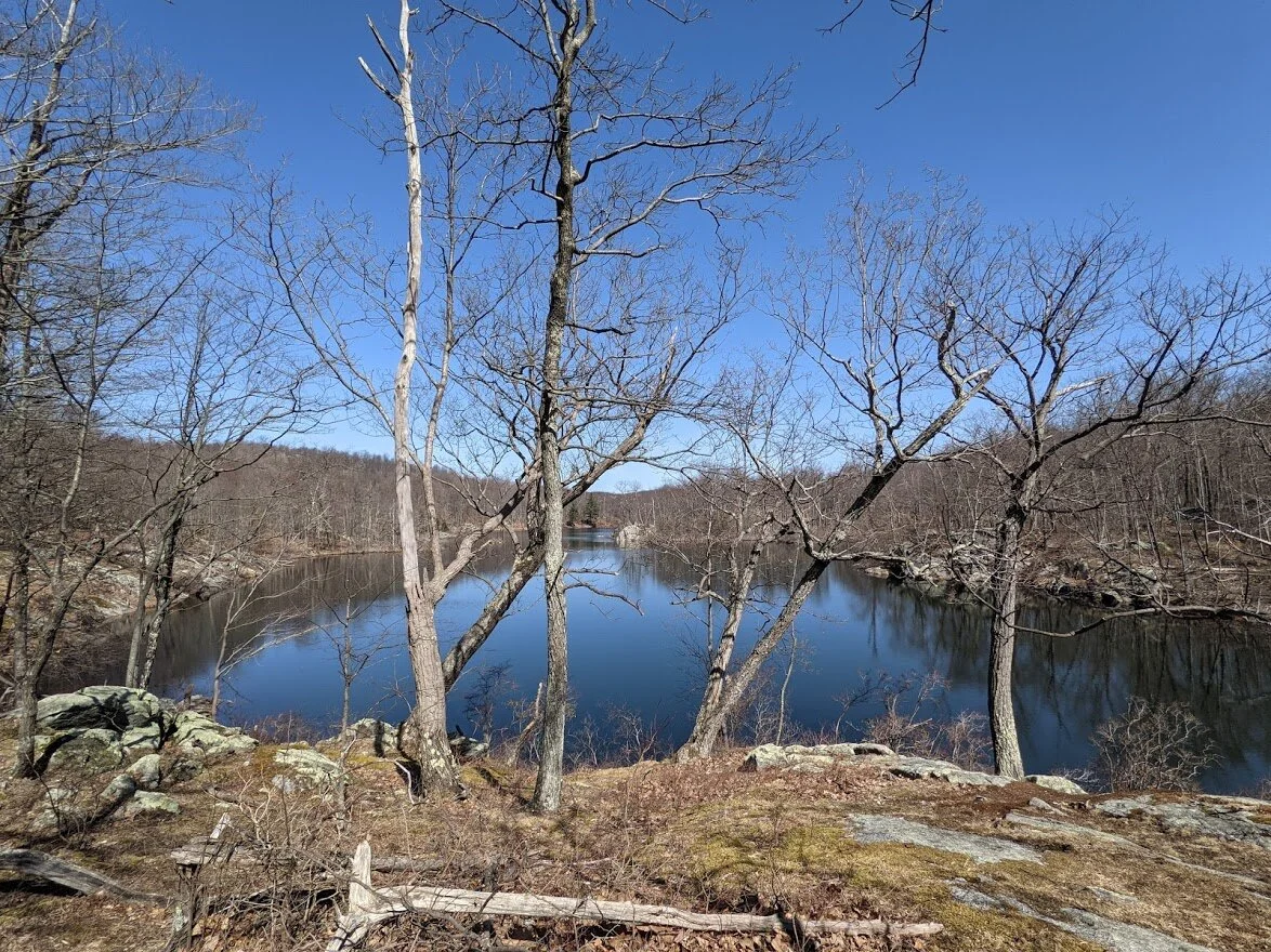
The lake is stunning.

I wasn't sure if this was the maps viewpoint, but I think it is.

I was startled by this sudden dense path of snow. On a short, steep incline no less!
Lake Sonoma has a very interesting shape. When you look on the map, it looks to me a little bit like a jumping dolphin.

Lake Sonoma.

Lake Sonoma has several viewpoints along the yellow/orange combined path.

Looking in southerly direction (from where I had just come).

I love the reflection in the water all around Lake Sonoma.

The photos couldn't quite capture the simple beauty of the reflections.

But I tried.

Lake Sonoma looking north.

You dodge west from the short of Lake Sonoma for a bit, but don't worry - this isn't the last you've seen of the lake!

Where the yellow splinters from the orange blaze.

The orange follows old woods roads, and some roads used I'm certain by the trail maintenance crews.
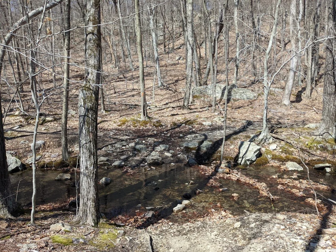
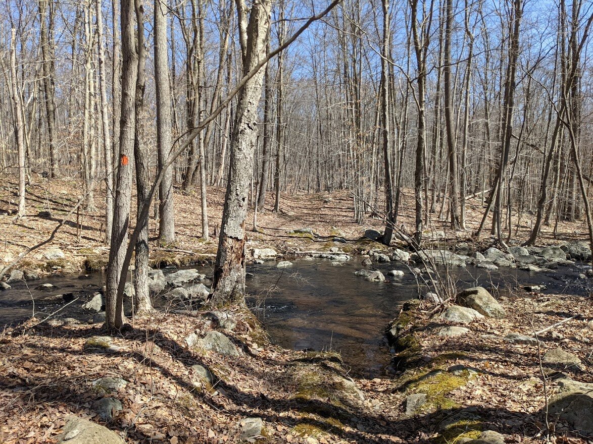
You'll cross Burnt Meadow Brook about a dozen times before you're finished with this trail!

Burnt Meadow Brook.

Lots of little waterfalls at every crossing! Some crossings were easy to rock hop across, while with others I was very happy to have worn mid waterproof boots!

Brunet Meadow Brook

Burnt Meadow Brook feeding into Lake Sonoma.

The northern end of Lake Sonoma.

Here, the woods road in the spring is quite a wide, muddy mess with deep pockets of standing water. Make sure you wear boots that will allow your feet protection against the slick, messy mud. Please do not endanger the delicate ecosystem and make the puddles wider by walking on the dry sides.

Lake Somona, looking south.

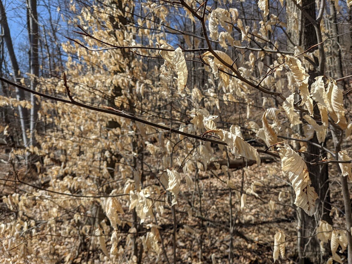
The American Beech trees were hanging onto last years leaf cover. In the wind they would rattle and make a raucous all together. But they sure are pretty!

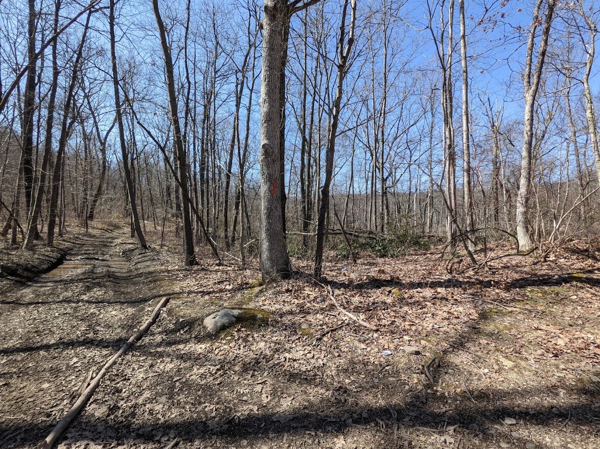
So, here this interesting thing happened.... there was a trail head for another orange trail. Which went in a different direction from the orange trail I was on. And didn't appear at all on my photo map of the revised routes, nor on my 2017 map. I don't know where it leads. I chose to follow my chosen path. But just beyond this little hill there are signs of former (and more recent) human occupation.

Along my intended Lake Sonoma trail, I came across this old stove, standing on a slab of rock. There didn't seem to be any kind of walls, so I wondered... what was this for?

Up close and personal with the old stove.

This is where the trail markers are convoluted. You come out from single track onto this very used woods road. This is looking down the road to the right, but the trail markers tell you to go to the left....

... this si direction you're headed in. See the trail marker on the tree to the right of the photo? It clearly says, "Turn left" but if you look closely, there is no trail to the left beyond the tree trunks. It actually goes straight up the woods road on the right side of the large boulder. I followed the road, but there weren't any markers again for at least a quarter mile.

The road is dotted with enormous eroded ruts. I have seen joyriding dirt bike and ATV'ers in the area. It's clearly marked foot traffic only, and this is a prime example of the damage that off road vehicles cause to the delicate trails in spring.
Not much further up the road, you'll turn onto double track trail. It's more like a slender carriage road that nature was reclaiming than hiker track.

Oh look! Brunt Meadow Brook!

So this was the coolest thing I have found on trail. It appears to be a rock conveyor belt from the early 1900's. I examined it as best I could, but it age and humans looking for pieces of it to take home have left it in ramshackle condition. Interestingly enough, I didn't not see any nearby mines or prospect mines.

Looking down the length of the conveyor belt.

The opposite end.

Looking down the length from the opposite end. If you want to see this but don't have time to dedicate to a 6-hour hike, park on the northern side of Burnt Meadow Road and walk south the the first orange blaze (before the bridge). Turn right onto the Lake Sonoma trail and follow it for a mile or two and you'll find this at a major turn in the trail after the woods road turns to single track.

Single track turns to woods road.

It's very pretty along this stretch with Burnt Meadow Brook to your left and the view beyond the trees as your guide.
Oh look! Burnt Meadow Brook! And more waterfalls!

This portion of the Tapawingo Trail has opened, and it leads north to the Burnt Meadow Trail (green blaze).

Imagine that! Another crossing over Burnt Meadow Brook!

Looking west from Burnt Meadow Brook. This was another area where I had trouble finding the trail marker. I just continued on the woods road, though, and there was a marker hidden behind some long hanging branches.

Not much further down the road you'll find these signs and wonder... why are these signs here? Especially since to dumped garbage is much further down the trail.

Despite the signage, there is MUCH dumping. It's gross. The signage doesn't do a thing.

But before you reach the dumpage, you first have to get through sections like this, which have been chewed up with illegal off road vehicle activity.

Thankfully, you aren't on the damaged woods road for too long.

This Brunt Meadow Brook crossing was difficult. I couldn't cross on the trail. I had to find a better place to cross a few feet to the right of the trail, before the waterfall. It required poles, large steps on slippery moss-covered rocks and stepping into the brook. I had no problems, with my waterproof Bridger Vent Oboz boots and Montem trekking poles, though!
See this little smattering of rocks to the right of the trail? That was my best crossing point.

Aaaaaand then you get to dumpsville. It starts with a few empty bins. You're like, what's this doing here? The closer you get to Burnt Meadow Road, the more broken, empty bins you see all over the forest floor.

And then you get the road. It's pretty shameful. As far as the trail itself is concerned, though, you'll join the Stonetown Circular (white with red triangle blaze) for a very short section here.

Anyone need a mini fridge? This dump is recent.

The Stonetown Circular blaze. Just under this marker were old hoses covered in moss and dirt, and a paint can and other bits of metal and glass.

A bridge gives you a clean crossing of Burnt Meadow Brook.

Luckily, there didn't appear to be any garbage in the brook itself. Just the land surrounding the road.

This si the lowest point on the Lake Sonoma Trail. From here you climb up and up. And then down. And then back up just because you went down. And then down for good measure. About 15 times.

Where the Stonetown Circular meets the Lake Sonoma. You're about the climb into one of the prettiest sections of the trail.

Oh look. Some one dumped wood pallets. In the middle of the road, someone had decided to BURN the wood pallets. That's smart. Burning wood pallets in the middle of a dry forest.
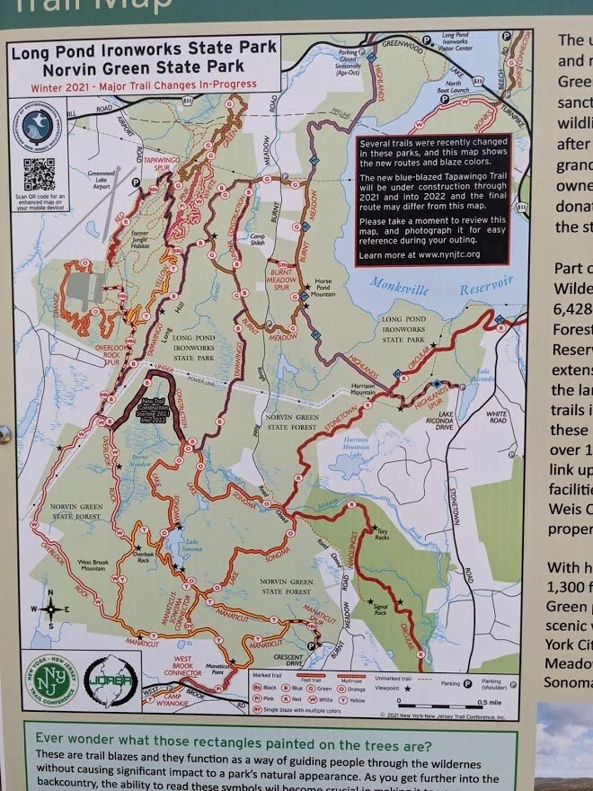
Here's the best map of the new trails I have. Take this and use with good intent. No dumping, please!

This real significant elevation gains in the trails starts right here. Right now.

And the view is worth it. In any other time of year, the leaves would obstruct this gorgeous view.

It's nearly a 360 view from the top.

And the warm sun and the butterflies will cheer your heart after your walk through the disheartening garbage dump.

Once you get to the south side of the mountain, the terrain changes and gets rocky.... much more similar to what you hiked through on the spur trail.

Lots of ups and downs from this point on, mostly steep and rocky. There aren't may gradual inclines on this side of the mountain until you get back to the trail head with the water damaged print out of the new map.

This was my last photo. I had just come from up there, and was really proud of myself. A few hundred yards further I reached the end of the wonderful Lake Sonoma trail and followed the Manaticut Loop back to the spur trail, which I ended my hike back on Crescent Road. What a fantastic day!