
Where am I going?
Highlight Hiker Blog
Newark-Pequannock Watershed, Highlands Trail at Dunker Pond
October 3, 2020
I stood there at the creek crossing, wondering if the raccoon was dead. I hoped it was sleeping, lying there prone, a short footstep from the crossing. Raccoons frighten easily. It should have moved by now, were it alive. My pupils dilated when I first spotted it. Most wildlife that you stumble upon in the wilderness outside of the chattering chipmunk or busy squirrel gives you a momentary “WHAT THE…???” reaction until your brain processes what you’re seeing. But I had pins and needles under my skin knowing that I was going to cross over a dead animal. Wondering if it was placed there as a lesson or an omen from the Universe, or if it was just old, sick, dying, drowned, poisoned….? Poor little fella. ‘One slip on these rocks, and I’m going to step right on that thing.’ I thought to myself. “Better not slip, then.” I said. I was the only person there to heed my own advice.
Fortunately, I didn’t slip. At least… there. I nearly fell on the other side of Dunker Pond while picking my way across a boulder field. I mapped my line with a route over a big boulder that, in my experience, should have been secure. Turned out if was a wobbly son of a gun and dumped me to one side as though someone unexpectedly hit the target on my personal dunk tank. I kept myself from falling; momentarily caught with both feet in the air, back-step-hopping, arms wheeling trying to stay upright. With a plethora of inappropriate phrases skidding from my mouth. I caught my breath and settled my heart rate before turning around to glare at Mr. Wobblestone. I wanted to recognize him when I came back. “Creep!” I spit at him, then very carefully picked my way through the rest of the field.
Needless to say, the remote and under-explored Highlands Trail is not for the faint of heart. My 6.5 mile out-and-back hike was rife with challenge and triumph… and too many face-height cobwebs to count. Most of which I couldn’t dodge or didn’t see, wiping the remnants of some spiders hard work from my eyes, nose and mouth. Additionally, my overall elevation gain clocked in at over 2,400’: the second highest on record for my day hikes. I knew looking at the map that this hike would be challenge. I didn’t know it would be geared to test my mettle.
As they say, though, the greater the challenge, the sweeter the reward. And so it is here. Passing through a labyrinth of stone walls constructed by former residents who lived in a close community long ago. Seeing Dunker Pond slowly come into view through a thicket of trees. Crossing the mirror of Dunker Pond Brook. Feeling the accomplishment of climbing 400+ vertical feet in less than 2 tenths of a mile. To have seen it/experienced it/felt it/conquered it despite the burning tears and burning lungs and burning legs and burning desire to be done. I’m proud. I’m proud of myself for doing it the right way - taking my time to heal and getting through that kind of challenge unscathed. It’s not luck, it’s experience and knowledge. You don’t have to worry about me. I’m ok. I’m better than ok. I’m thriving. I passed the test of the Highlands with an A++.
Hello again, P9 parking area. P9 is comfortably large and can hold up to 7 cars in this one spot. There is plenty of room on the woods road to fit a few more cars as well.

To get to the Highlands Trail (teal blaze), I first had to hike in on the Bearfort Waters Clinton Trail (yellow blaze).

NEW GEAR!! Osprey Sirrus 24. Isn't she a beaut'??

The Clinton Reservoir is quite picturesque this time of year.

Fishing on Clinton Reservoir, Newark-Pequannock Watershed.

Sun glistening off the water in the long autumn afternoon.

Clinton Reservoir.

Clinton Reservoir looking directly toward Buckabear Pond.

Still on the BWC, although the last time I was here this seasonal creek bed was a tough crossing.

Now it's dry... even after a long rain from the night before.

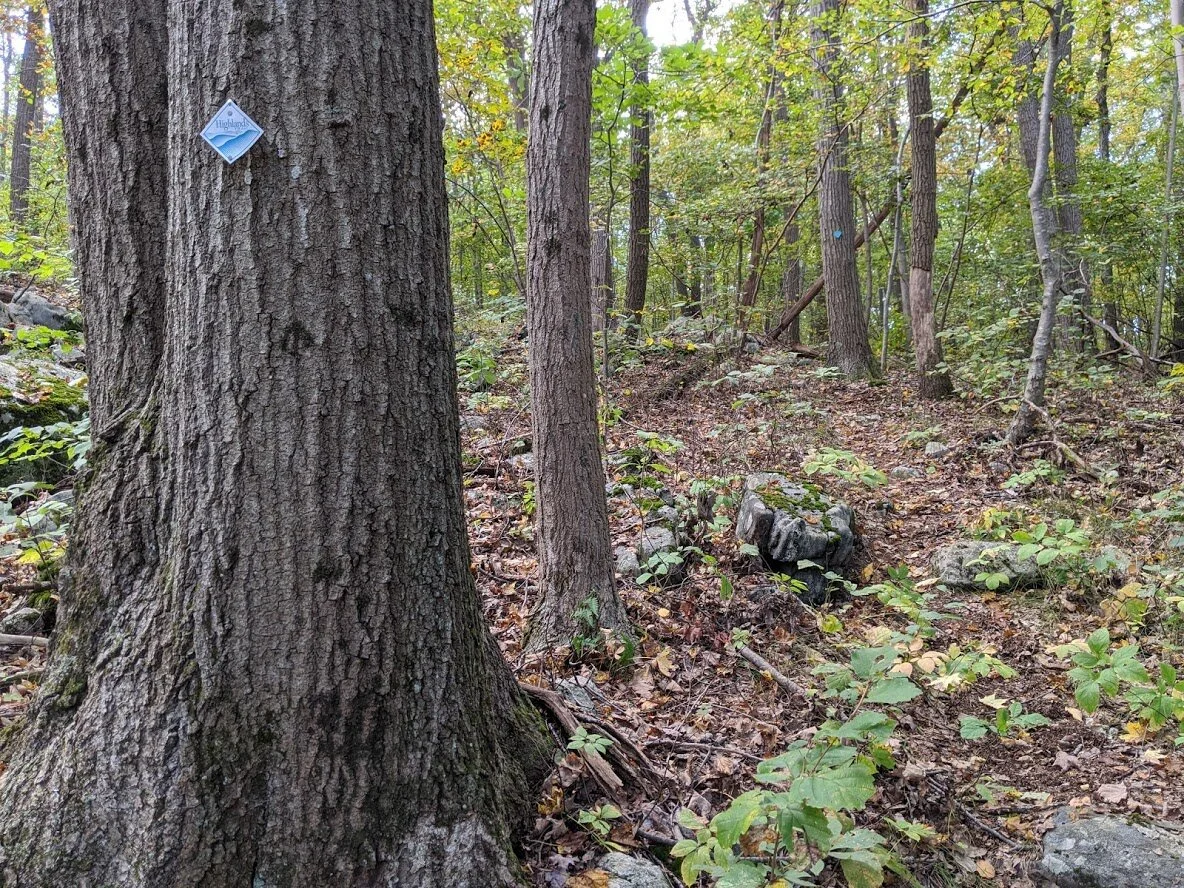
First look of the Highlands Trail. Due to the lack of visitors to this section of the Highlands, you'll find sparse single track through diverse terrain, but the trail is very well marked and you'll be hard pressed to get lost.

When you fall in love with the trees...

Does anyone know what this thick black goo is dotting the leaves? UPDATE: after some research, I'm making my best deduction that this is sooty mold. https://en.wikipedia.org/wiki/Sooty_mold

I chose this route for it's many woods roads that lead back quickly to P9, in case I happened to reinjure my foot. Thankfully, none of those escape routes were needed.

The trail, as well as the woods roads, are well maintained within the watershed. There were no deadfall obstacles. Everything had been carefully cleared since the last batch of heavy storms.

The stone walls found on the eastern portion of this trail are the best preserved I've seen throughout northern New Jersey's hiking trails. This particular wall was more than 3' high. The further into the woods I went, the larger the labyrinth of stone walls. I am so curious to know about the former residents of this area that I plan to do some research and will update you with my findings.

I walked over and beside the stone walls as they kissed and departed one another in every direction.

I was surprised at how much wider these walls were over the others I've seen in this area.

Well constructed and virtually impenetrable.

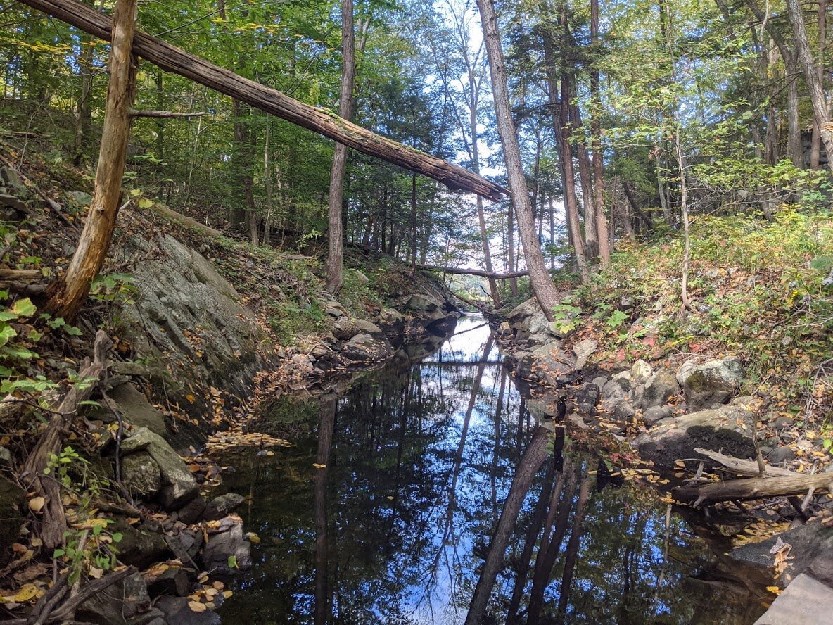
This was the first of many creek crossings.

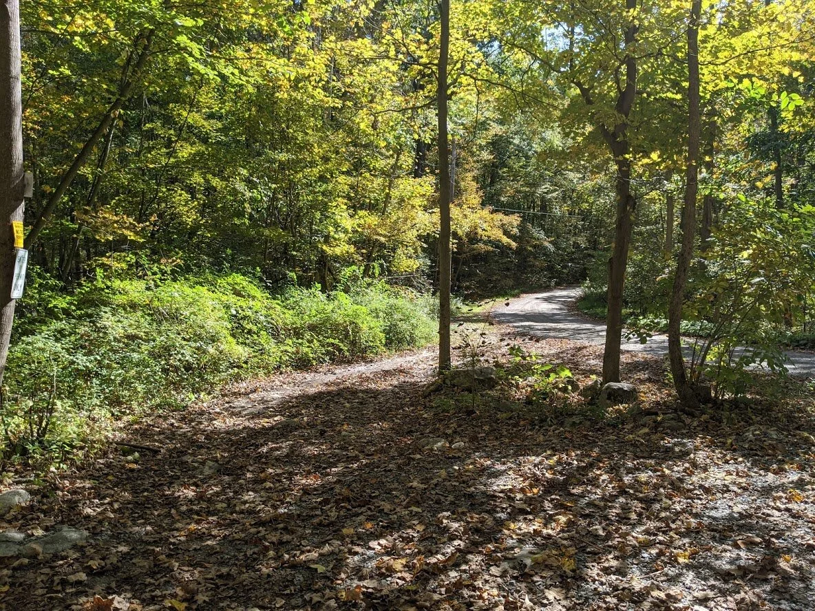
This old carriage road has a name: LUD Day Road. This is the woods road that I would take to my car on my way back. It was a much more direct route, and saved me oodles of time. Looking south on LUD Day Road.

Looking north (the direction I was headed for a few hundred yards) on LUD Woods Road.

Heading back onto single track, this section of trail is where I was pummeled on the face with cobwebs. Clearly no human had passed by on this road in quite some time! Good thing I am not afraid of spiders.

Anyone know why this maple tree trunk has a dark patch?

Yep. That's the trail. It crossed through spectacular fern covered marshland. I'm so glad I decided to purchase waterproof boots. I was hiking through 1" thick muck.

Can you see the trail? Climbing down 300' in thickets of trees.

The trail swings south to avoid deep swamp on the southern tip of Dunker Pond, where you find a small stand of pine.
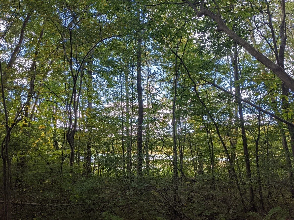
The first glimpse of Dunker Pond between the trees at 900'.

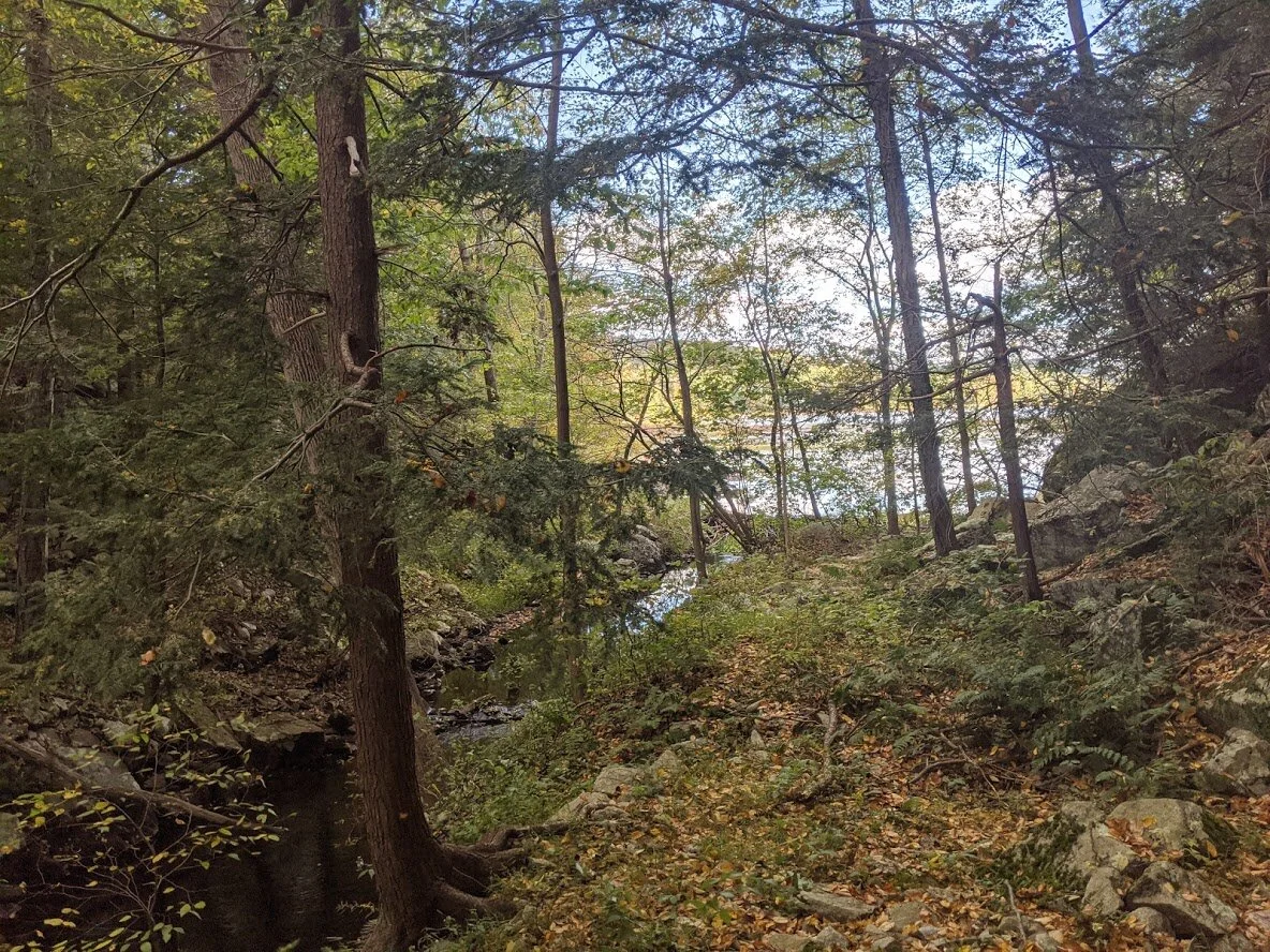
Peek a boo! I see you, Dunker Pond! The mountain I was to climb hides all noise of humans occupation, and the pond feels like a solitary oasis near the hustle and bustle of busy Rt-23.

AH! A BENCH!! You know how I love benches.

The view from the bench. Dunker Pond.

Dunker Pond was teaming with wildlife: Canadian geese honking, a great blue heron surveying the water from 1,000' above, the gentle splish-splash of amphibians leaping to watery cover, and the scampering of muskrats along the shore.
The trail diverts south again, and follows Dunker Pond Brook: the waterway that feeds away from the pond, and eventually empties into Oak Ridge Reservoir.

The crossing, around 880', is wide but not treacherous, so long as you don't take your eyes off of the rocks to admire the view.

Rushing water swirls at your feet during this crossing. I would think it is exceedingly more difficult in the spring when the water is at its highest.

From about 20' - 30' above the crossing...

And then begins the climb up Dunker Mountain. You went down 400', now it's time to climb up 500' (just to descend another 500' to get to Cannistear Road... only to turn around and ascend the same 500' you just climbed and then descend to get back to Dunker Pond. A lot of going up just to go back down)!!
Nearing the end of the climb and the cold air starts to sear the lungs. Once you crest Dunker Mountain, all signs of humanity (from traffic, blaring music, laughing and happy shouting, to airplanes overhead) break the illusion of complete solitude.

And another stone wall to remind you that human occupation existed in these dense forests not so very long ago.

Looking down the barrel of the last, steep 100' or so of the climb down to Rt-23 and the train trestle parking area off Cannistear Road. I only took one photo when I got down there, and it was blurry. My apologies.

Up, up and up again. Up away from the noise, up away from the lowering sun. Up away from the blooming fleabane and into the quiet of the forest.

In the center of this photo is a very large, flat boulder. Not the one directly behind the tree trunk... the big boy that is behind it. Mr. Wobblestone (I presume) is on the right of that big flat boulder. You might not be able to spot him but I can. I know him personally. And he's a creep.

I took no photos on my way back. I hastened home because it was getting late. Sunset was at 6:34 pm and I still had to walk to the car in the shadow of the mountain that I had just climbed... twice. This is looking north on LUD Day Road.

Looking south on LUD Day Road. It drops down the mountain and intersects with Paradise Road, just round the bend from P9.

My current NY/NJ Trail Conference Map #116 (12th edition). At the bottom of the map you'll find a "Trail blaze directions" key. Directly above the key is P9, and to the west is Dunker Pond.

This is the "before" image...

... this is the "after" image. A job very well done, indeed.

I usually find some kind of treasure along the trail. A keepsake of some sort. Usually it's a leaf or a rock in the shape of a heart that was presented to me at my feet. This time, it was a tool!! I took this to mean that my foot was fixed. HA!