
Where am I going?
Highlight Hiker Blog
March 10, 2021
Norvin Green State Forest
Ball Mountain, Roomy Mine, Blue Mine, Roomy Falls
IT’S HIKING SEASON!
After such a long, restrictive winter, I was beginning to wonder if spring would ever return. But lo! It has. FINALLY.
Just to get you up to speed: I am hiking all of the marked trails on NY/NJ Trail Conference maps 115 & 116. Over the course of 2020, I was able to complete all but one trail on map #116 (including the new blazes in Abram S. Hewitt, which you can find HERE). The last trail left is a portion of the AT through Waywayanda which includes Stairway to Heaven, which I will hike this summer.
Therefore, it only makes sense to move back to map #115, and see how much I can churn out over the 2021 hiking season.
I decided to start with a relatively mild trail. While I kept up with my training over the winter, I fell out of hiking condition a bit and I wanted to ease back in. Looking at my map, I felt that the small section including Ball Mountain, Roomy Mine and Roomy Falls would be the perfect place to begin. And, I have to say it was!
The terrain was really good, it wasn’t terribly snowy or muddy, and there are so many cool things to see! From scenic viewpoints, to NJ mining history, to bridges and waterfalls and one of the biggest boulders I have ever seen!
Most folks start this hike at the New Weis Center, but I took a little different route in. I parked roadside on West Brook Road and followed the Highlands Trail (teal blaze) in. If you’ve been following my blog for awhile now, you’ll know of my fascination and love of the Highlands Trail. I only hiked a small section of it on this day, but not to worry, I’ll be tackling the Highlands in larger chunks in the fall (as it is the best of time of year to explore the Highlands, of course. Please!).
Once I reached the Roomy Mine Trail (orange blaze), I followed it to the top of Ball Mountain with it’s pretty mountain view. After I admired the scenic point here, I went down the mountain on the Fried Egg trail (white with a yellow center). Disclaimer: Fried Egg Tail is NOT the official name of this trail, but once you see the blazes, you’ll be with me in wanting to have it renamed. It’s official name is Mine Trail. BOOOOOR-RING! I much prefer Fried Egg Trail. No matter what you call it, this trail took me down past prospect mines, and because the trees have not yet flushed, another beautiful scenic view point that is not listed on the map.
Rather by surprise, I came across Roomy Mine quickly once I dropped down from Ball Mountain. The mine is closed at this time of year to protect the hibernating bats who call the mine home. I respected that and did not enter. In fact, I stayed pretty far from the entrance because while I love and appreciate bats, fun fact: I am repulsed by bat guano.
Taking in the history and admiring the rock, I eventually followed the orange trail in a loop to the red, back to the yellow, and then to red/yellow blazes where they join the Highlands Trail. Here I took a break on the bridge that crosses Blue Mine and lo! I spotted Blue Mine itself right there from the bridge. Blue Mine was discovered by Peter Hasenclever and named for it’s distinct color of iron ore.
When I was finished appreciating Blue Mine, I headed back to the bridge and passed the stone shelter built in the 1930’s by the Green Mountain Club, and then steadily climbed Fried Egg Trail until I came back to Roomy Mine Trail. I really enjoyed this section of trail. I saw a relatively fresh bear print in the mud, which I took of picture of, though it’s kinda’ tough to see.
When I came to the top of the Blue Mine Brook Falls, I had another little break and took a short video of the water as it swirled and pooled before dropping down the rock face. Oh, and I found a flip flop. A single flip flop that was sticking up out of the melting snow. So I plucked it out of it’s wintery casement and took it with me to dispose of.
Then it was back up the steep climb to the top of Ball Mountain (all covered with cheese), back to Highlands Trail and my car.
I didn’t research this trail before my hike: the mine, the falls, the mountain and all that goes with it. I just walked out the door and went walking through the woods. And it was really delightful because I found so much history throughout. It seemed like every corner had a surprise waiting for me, and I was beaming the whole time.
This is my introduction to Norvin Green State Forest (outside of Wyanokie High Point), and I have to say: I’m impressed. And I’m really looking forward to seeing what other treasures of time it holds for me as I explore further.
UPDATE 3/28/21:
Check out this self guided tour brochure from NJDEP! Fantastic deep dive into this exact area.
Norvin Green State Forest
Ball Mountain & Roomy Mine
Total Mileage:
4.5 miles.
Total Elevation:
1,319 feet

A short road walk from my parking spot on West Brook Road, and up onto the mountain I go. At this time, there were still slick snow and ice patches, but they are long gone by the time of publication.

The further you climb, the more erratic it becomes. Da-dum-dum. Little geology joke for you, there.

I loved these three marbles, just chillin' on a rock slab.

You can see the snowy trail on the edge of the rock. This side of the mountain was the only side with snow.

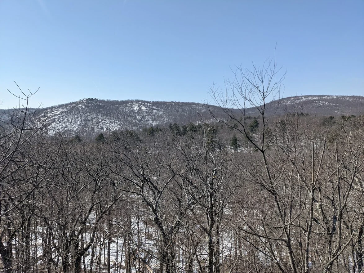
While the greenery in warmer seasons is beautiful, you can't see this view through the thick of the trees.

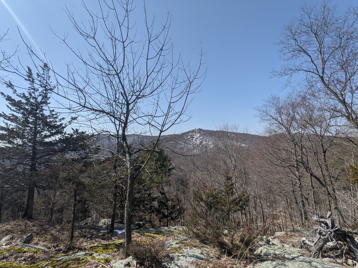
It doesn't take too much time to get to the scenic viewpoint at the top of Ball Mountain.

I believe this is Assiniwikam Mountain in the distance. I'm not 100% certain, but will verify.
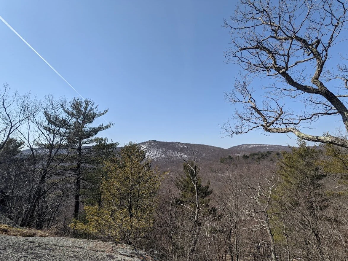
From Ball Mountain scenic view point.

From Ball Mountain scenic view point.

See? Fried Egg Trail!
Little peeks of the mountains nearby were scattered throughout the trail in the early spring months.

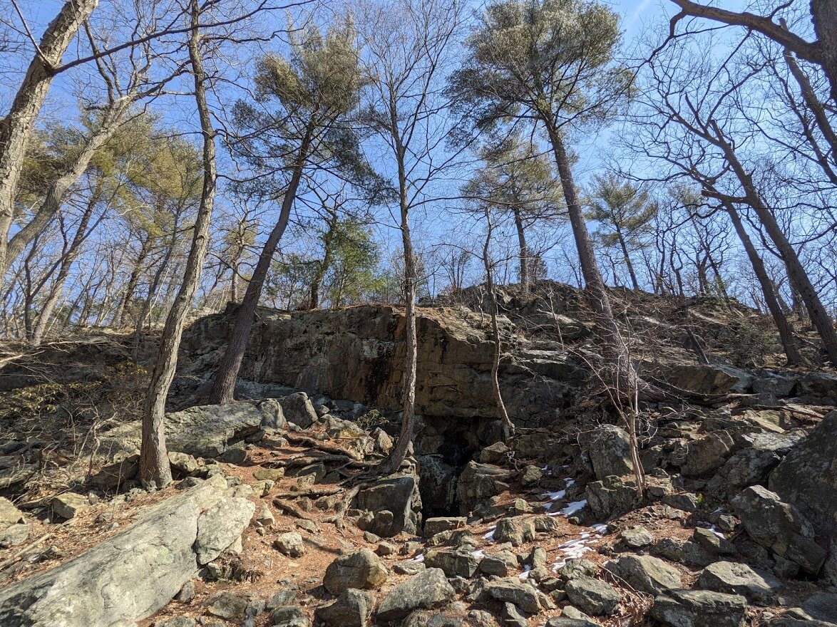
When I first reached this sign, I thought I had reached Roomy Mine, but this is either a shaft to the mine or a prospect mine. Still and though, you're not allowed entry until April 15th.

I thought this was Roomy Mine, but boy howdy was I wrong! This is either a shaft to Roomy Mine or a prospect mine.

It is most likely a prospect mine based on it's small size. When you're here, you are directly above the REAL Roomy Mine.

This area looks exactly like most of the prospect mines in the area: a depression in the land that looks abnormal.

Along the Fried Egg Trail/Roomy Mine Trail there are plenty of pretty views between the bare trees.

This is the second scenic view point (it is not starred on the map).
The scenic view just before you take a hard turn and head down Ball Mountain.
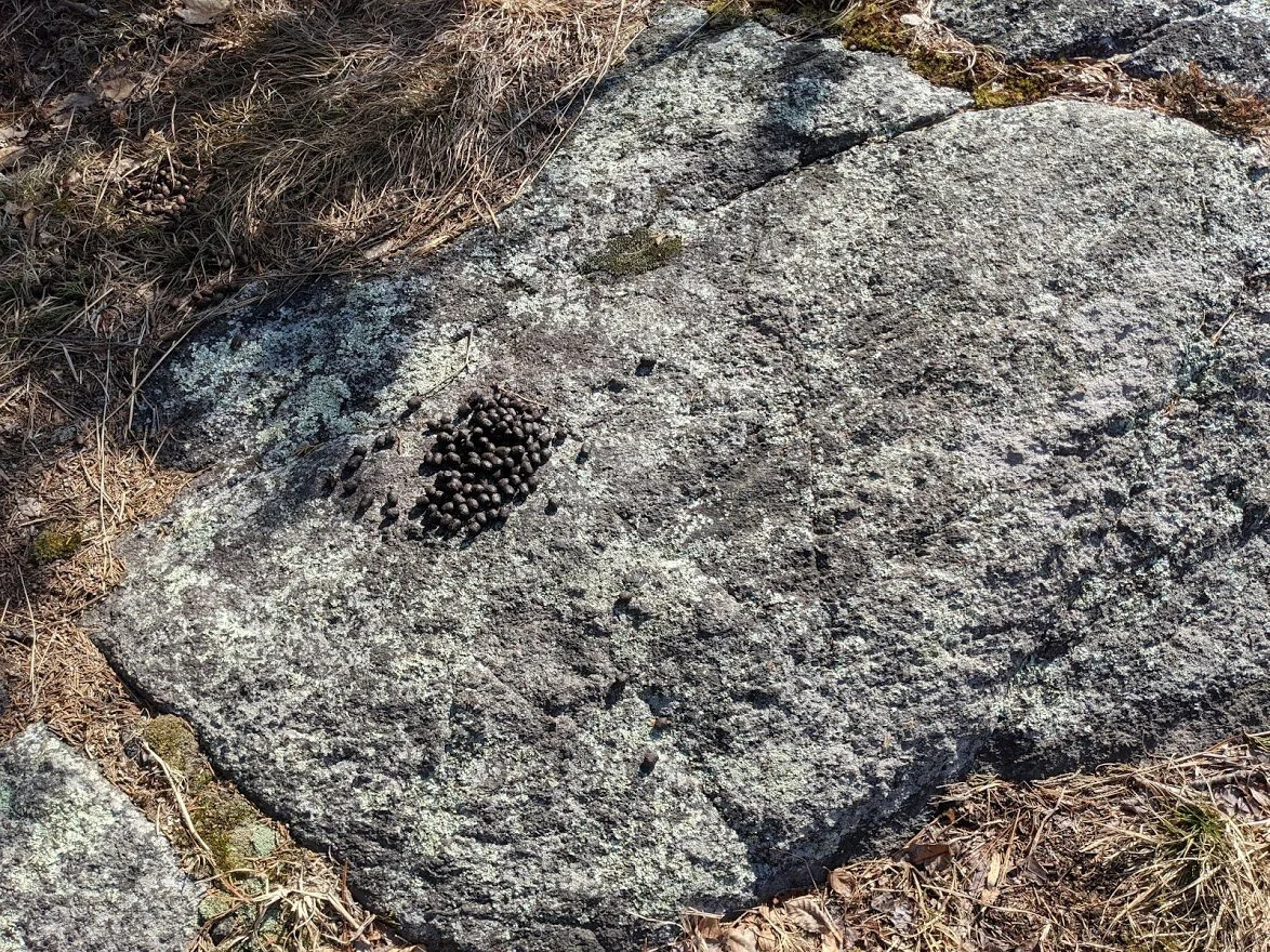
LOTS of poop here. Lots and lots of poop.

But what a view!

The shadowy mountains past Wanaque Reservoir never cease to take my breath away.

It was right around this spot that I saw a deer in front of me. She wasn't more than 10' away, and she wasn't at all startled by my presence. I stood on the trail and quietly waited for her to pass. She was slowly sauntering toward Roomy Brook.

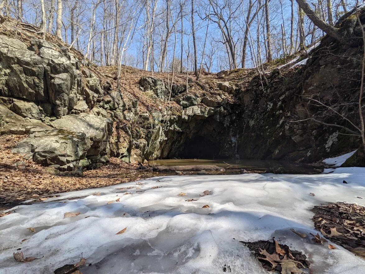
Now THIS is Roomy Mine.

You can't miss it. It's enormous!!

You'll hear Roomy Brook before you see it, and you'll cross it a few times before the end of the day.

Looking downstream of Roomy Brook.

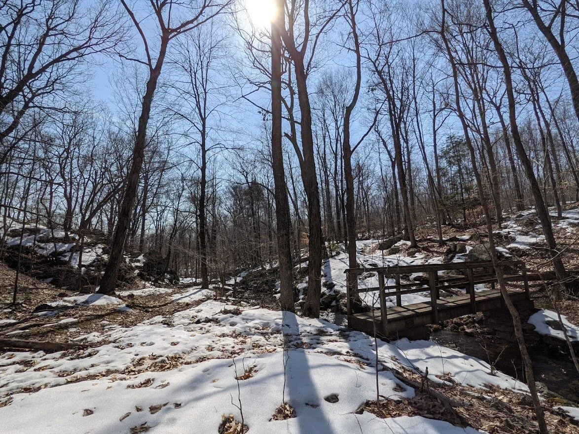
Where three trails converge you'll find a bridge, Blue Mine and enormous tailing piles (this is where the miners put the excavated rock they didn't use).

The quaint bridge over Roomy Brook.
If you walk just beyond the bridge on the left, you'll find Blue Mine.
Blue Mine, discovered by Peter Hasenclever (don't worry - I'll be talking about Hasenclever in more depth this year).

Stopping here, I put the protective end caps on my trekking poles and took a break, complete with granola bar and lots of water. The cool dry air made me very thirsty!

Highlight Hiker gear: Osprey pack, montem poles, and goat hat. Who doesn't love a good goat hat???
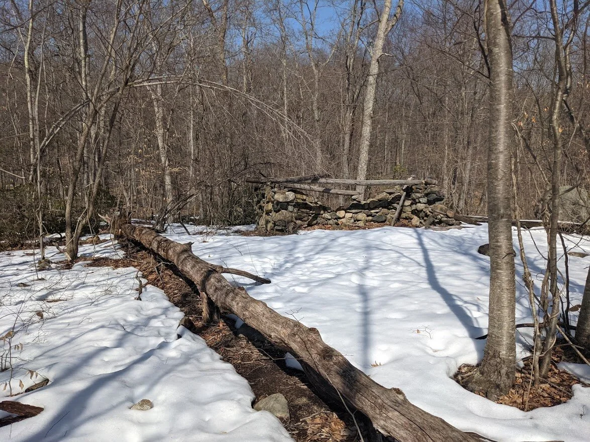
This is the stone structure built in the 1930's by the Green Mountain Club. Just a touch creepy, but historical nonetheless.

The red trail takes you up to Wyanokie High Point, but I turned right and continued along Fried Egg Trail.
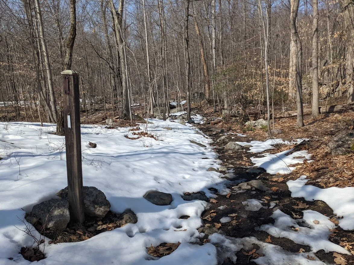
This interesting pole used to be a trail marker, I'm assuming, because it was placed where Roomy Mine Trail intersected with Fried Egg Trail.

See?

Here is the bear print. I wear a size 8.5 in Oboz boots. This bear print would be between a 6.5 and 7 in oboz footwear size. It was pretty big. And pretty fresh!

At the top of Roomy Brook Falls (where I found the flip flop and took video)

At the top of Roomy Brook Falls
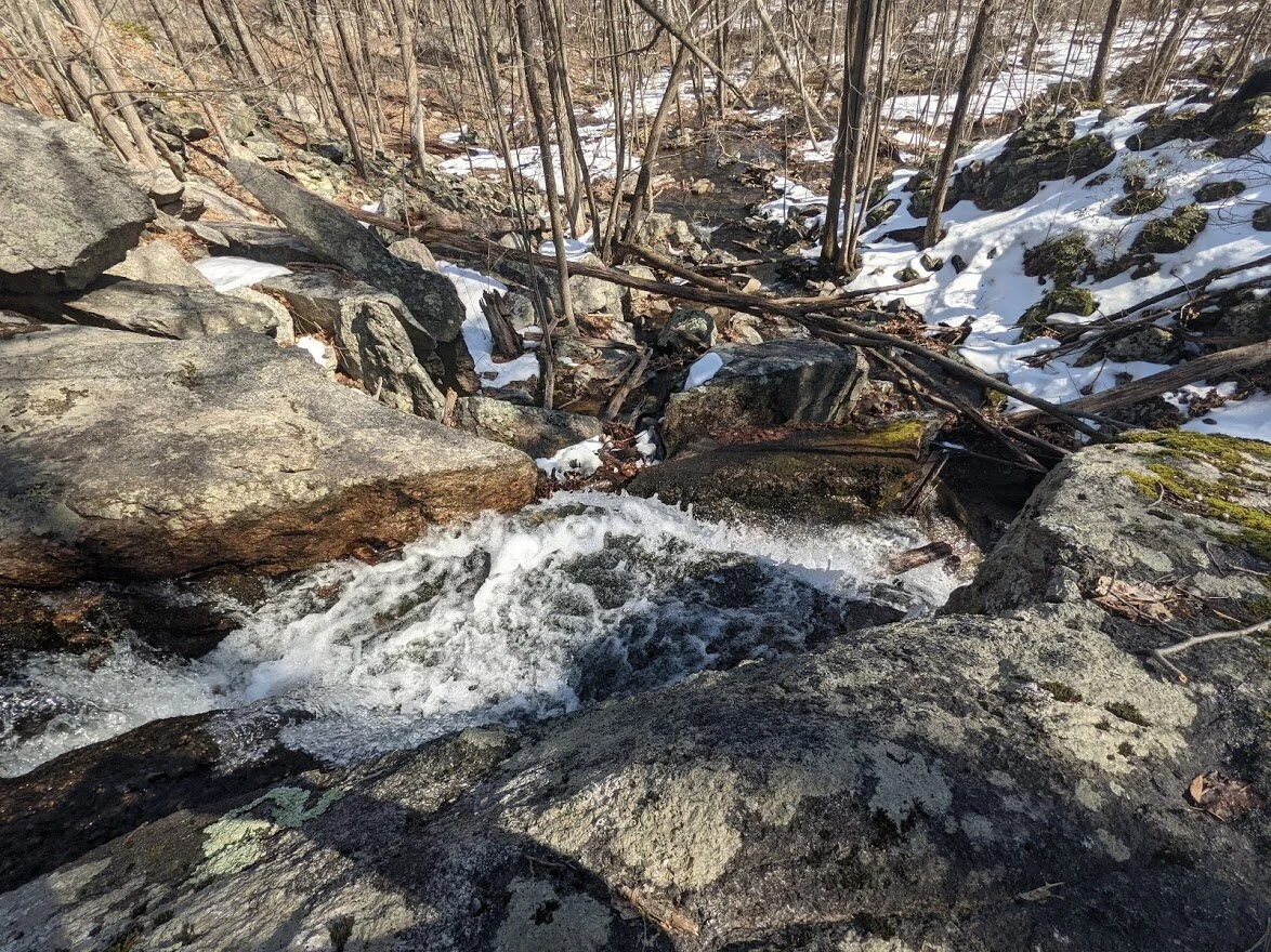
I leaned over as far as I dared to see the water rushing over the edge of the rock wall.

The crossing wasn't too terrible, but I certainly didn't want to misstep and put my foot in that deep, cold water!

From the Roomy Brook crossing at the top of the falls.

If you look between the trees, you can see Roomy Falls. There wasn't a direct path and there were a lot of blowdowns, so I didn't really care to get much closer.

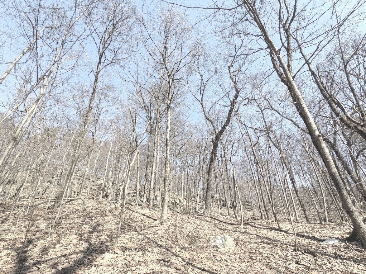
Even before the trees flush, it's easy to fall in love with the forest.
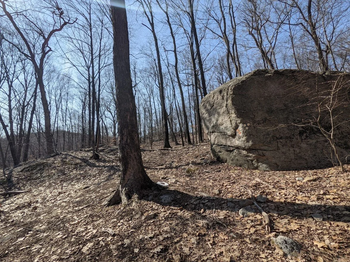
There it is! One of the biggest boulders I have ever seen. The picture doesn't do it justice!

FRIED EGG TRAIL!

Headed back toward the Highlands Trail, the short road walk and back to my car. One last view of the snow dappled mountainside on Ball Mountain. Thank you, Norvin Green!