
Highlight Hiker Blog

May 11, 2022
New maps! New trails! New goals!
I knew this day was coming. I knew that me beloved NY/NJ Trail Conference maps #115 & #116 were going to change. I didn’t expect quite a drastic change (new numbers), though I did know about most of the added trails. Some of them I completed or partially completed before the new maps were published (Tapawingo in Norvin Green, West Ridge in Abram S. Hewitt). But throughout my anticipation I’ve been asking myself: what do I do once I finish these maps? It’s going to happen eventually. I have been experimenting with other parks and other trails… but do I complete whole maps? Do I start going farther afield to the most popular destinations?
What do I want to do???
I still don’t know. SO! For now I’m just going to focus on the new maps and let that be that.
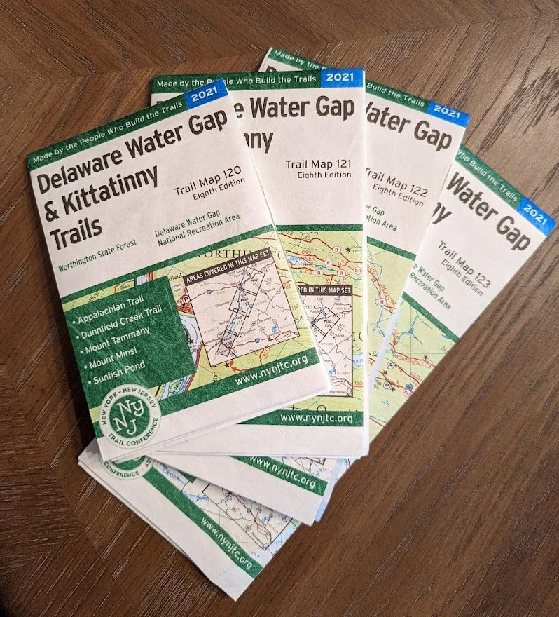
I purchased the new set of Northern New Jersey Highlands maps. What used to be a 2-map set, is now a 4-map set. If you already have maps #115 and #116 (last publication date was 2017) but haven’t yet purchased the new set, here’s how it breaks down. Divide map #115 down the middle at Wanaque Reservoir. The east side (to the right of the reservoir) is now Map #150. The west side (to the left of the reservoir) is now Map #151.
The former map #116 has been chopped up a bit more. The new Map #152 includes the northern portion of Waywayanda, northern portion of Bearfort Ridge and Abram S. Hewitt State Forest, while the new Map #153 includes the northern portion of the Newark-Pequannock Watershed area including the southern side of Bearfort Ridge and the Highlands Trail to US-23.
By expanding the maps there is greater detail of woods roads, mileage, elevation, parking locations, landmarks and the coolest new addition: bird watching sites.
A round of applause to all of the volunteers and the Cartographer, all who did an amazing job detailing, re-blazing, and drawing these new map sets!
In the gallery you’ll find the new trails that were either added or modified by the Trail Conference, and other parks that were probably not included in the former set.
I do plan to hike all of these new trails. In fact, I already started! Earlier today I hiked the new Five Ponds Connector trail and followed the woods road to Race trail, which led me up to Shepard Lake: a quick 5-miler and thankfully I went at a time where I didn’t disrupt a single mountain biker. A well planned hike!!
My only true solid disappointment in the new map set is the loss of one of my favorite ever trails, Spring North (RIP). The reroute creates a much longer ridge trail that extends Terrace Pond and turns it into a loop, but let it be said here that Spring North is the trail I talked about the most and that I encouraged everyone to try. It still exists, but it is no longer named, blazed or maintained. WAAAAAAHHHHH!
But, don’t be too sad… because I bought some other maps that might make your eyes light up. Scroll through the photos to see my new surprise goals!
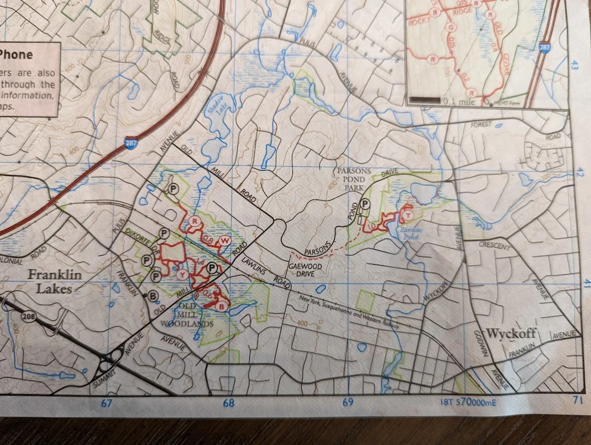
Old Mill Woodlands and Parsons Pond were not on the former map #115.
Ringwood Open Space trail was no on the former map #115

The new trail around Gatun Pond includes a scenic view of Brushwood Pond.
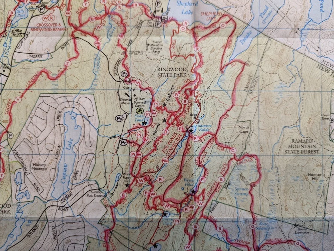
I can't say these are no longer highlighted! Today I completed the Five Ponds Connector and Race trail!
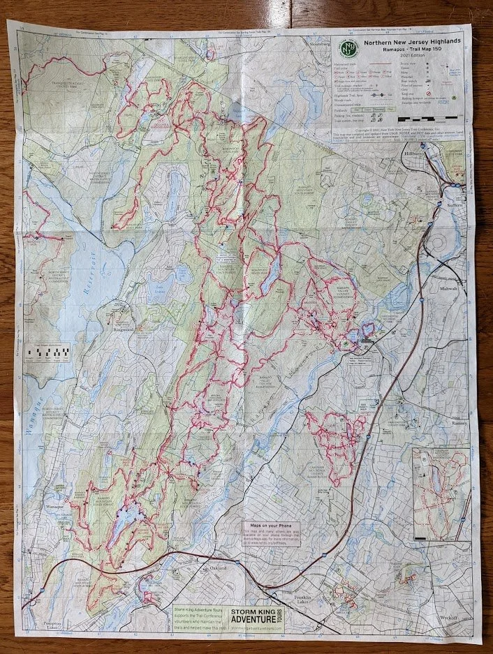
The new map #150 (half of former map #115). I already took my highlighter to the trails I've completed.
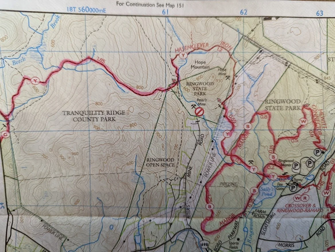
I knew the Hasenclever Iron trail was reconstructed. I dread it. I do not like the Hasenclever Iron trail. Never have. Never will. But I'll still do it. Only for you.
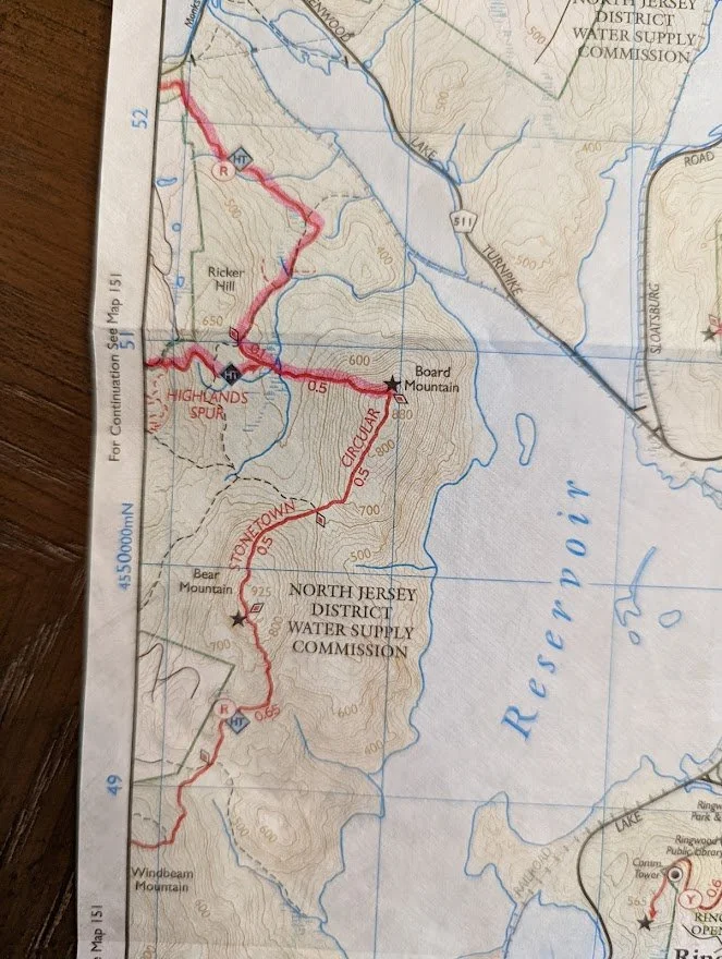
A small section of the Stonetown Circular (east) which we all know I haven't completed yet.
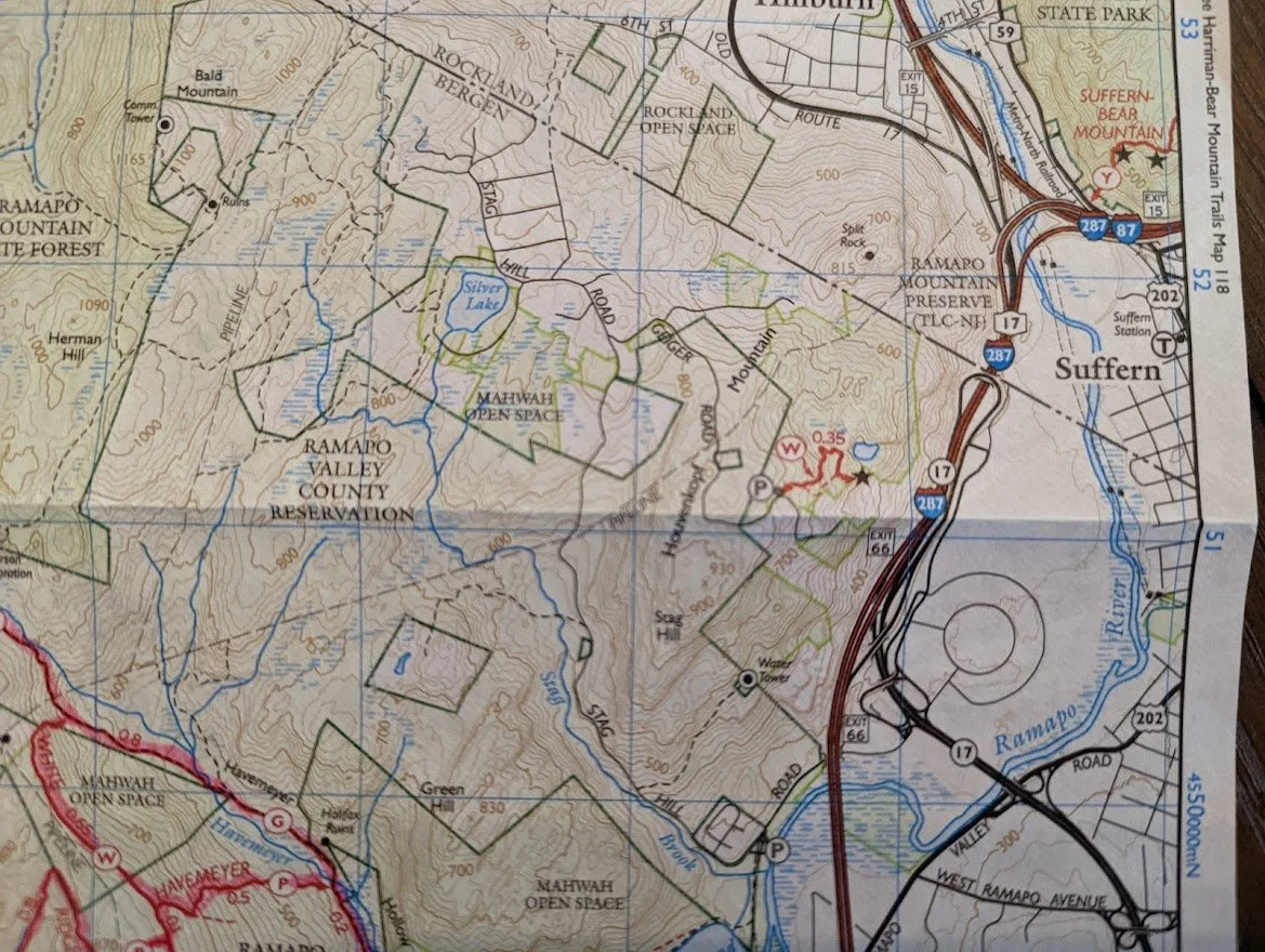
And then there is this random little trail near Mahwah which.... I mean, I never knew about this spot before. Did you?

This is Map #151. It includes the Nancy Conger West Brook Preserve, which was not on the former map #115.
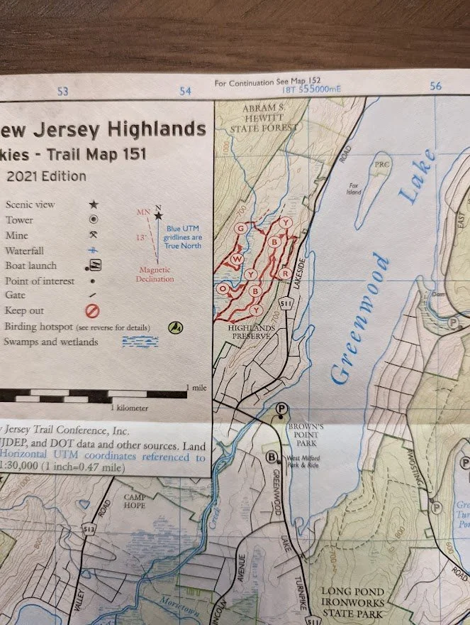
It also has a small portion of the Highlands Preserve, which I'm really excited about. These trails were unmarked and unblazed before! I had then on my to do list, and now I can make them a priority!
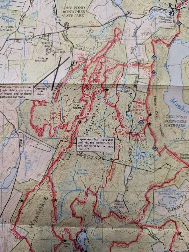
So, in Jungle Habitat I need to hike the new Tapawingo Spur, and the section of the new Tapawingo by Burnt Meadow Loop that hadn't been completed when I did the rest of it.
AND OF COURSE... Stonetown Circular. I have already climbed to the top of Board Mountain. I didn't highlight it on this map, though I did with #150.
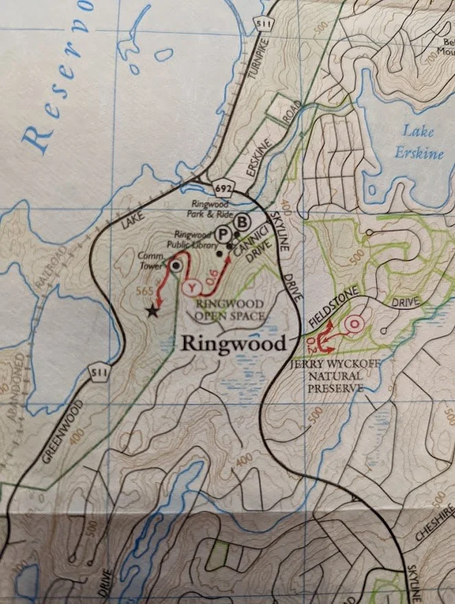
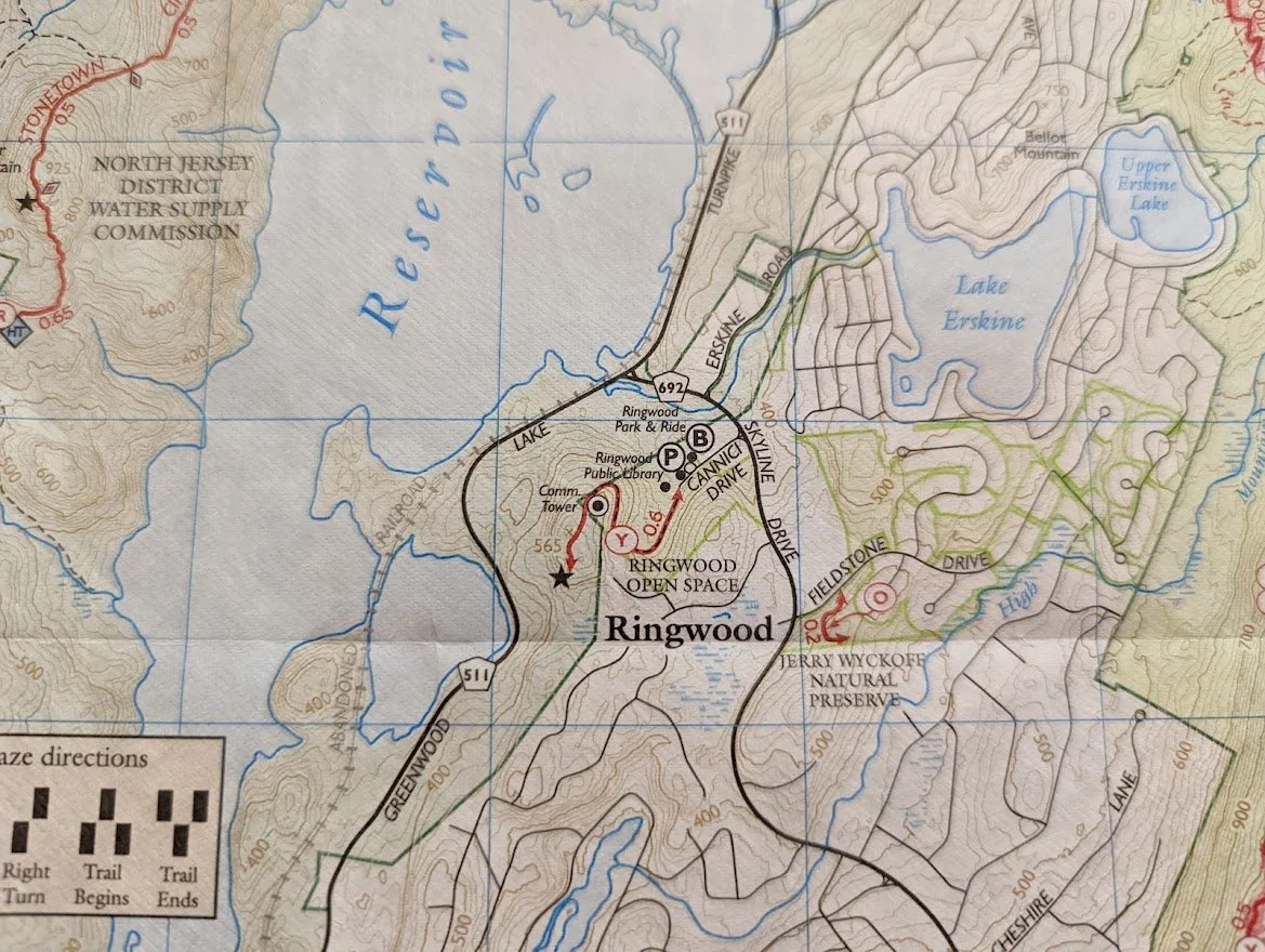
If anyone can tell me where to find the trail head for the Jerry Wyckoff, I'd appreciate it. The new map also includes the Ringwood Open Space trails.
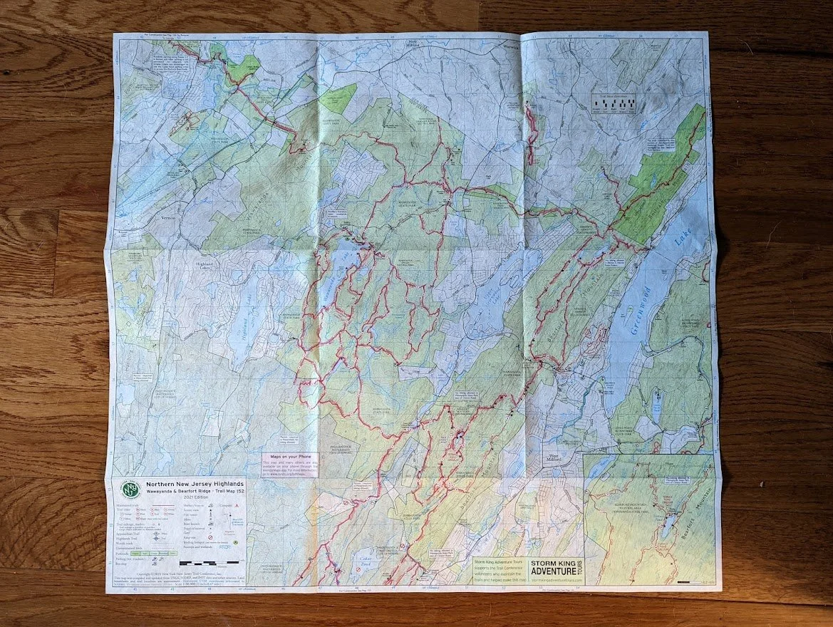
The new Map #152!
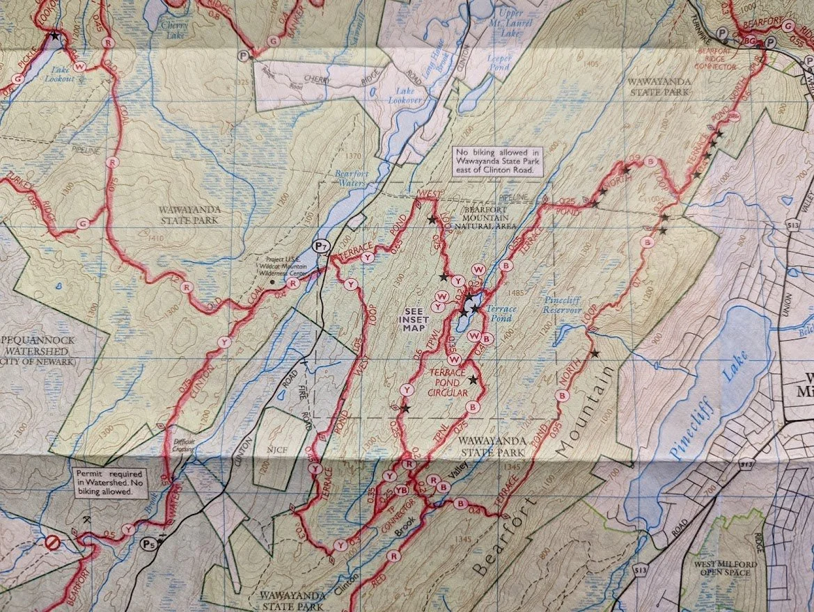
The brand spankin' new Terrace Pond North Loop

The last section of the AT that I have to complete, which I was waiting for a specific time of year to do.

The Maple Grange Park trails were not shown in the former map #116
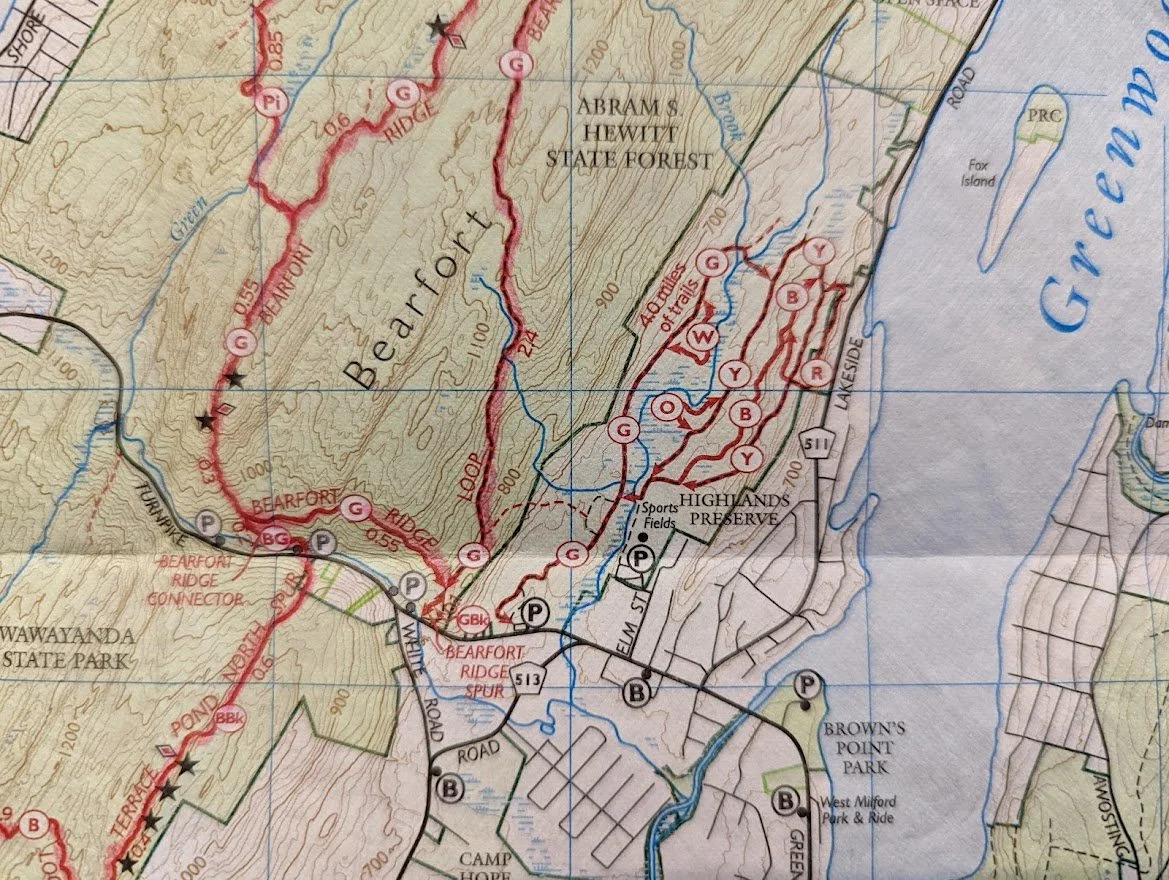
There are all of the newly blazed trails at the Highlands Preserve!
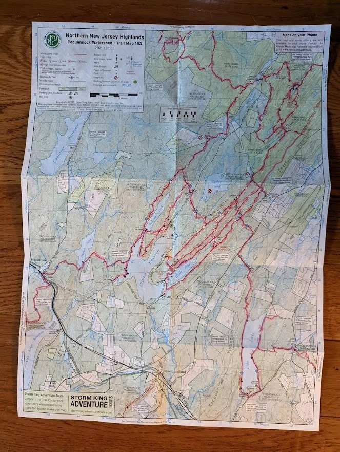
There is absolutely nothing new on map #153 and I have completed it with the exception of Two Birds trail at the southernmost part of the map
OOOH!! GUESS WHAT IMMA DO!!!
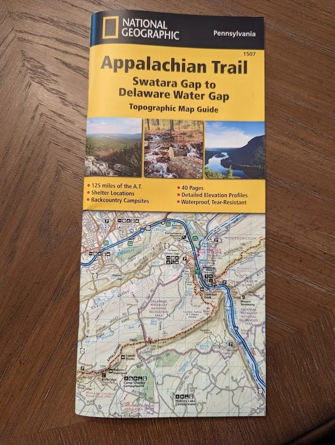
And a bought a much better map for hiking the AT in Pennsylvania. I'm so excited to go back. I have been studying every inch of these maps since I bought them.