
Where am I going?
Highlight Hiker Blog
Cabin Trail, Waywayanda State Park
July 18, 2020.
You can tell it’s summer in New Jersey. Know how I know? The heat! Whew! It’s a hot one out there! Good for me, though: I don’t mind hiking in the heat and humidity (when I’m well prepared with plenty of water), but most people do… which means the trails were noticeably empty this weekend. Very few people seem to know about the parking for the southern section of trails located on the western edge of Waywaywanda off Sheppard Road, and today was proof in the pudding! Only one other car, and I only saw two other hikers (who didn’t notice me at all). It was midday on Saturday, so I’d say that’s pretty perfect hiking!
ANYWAY! Enough about me, and more about the Cabin Trail, which is a marked trail in Waywayanda State Park, but turns into an unmarked woods road once it passes into Pequannock-Newark Watershed. This area is fascinating and full of history! But let’s start with it’s modern day features. Cabin Trail is a wide woods road with deep ruts that presumably is still used for access to the Tennessee Gas Pipeline that lines within it (more on that later, also fascinating). The trail has virtually no elevation to speak of, and what it does have are long, mild straight inclines. It’s a bumpy, rocky walk through the woods and in summer should probably be renamed to “Buggin’ Trail” because of the pesky persistence of it’s flying inhabitants who seem to think that you are the smorgasbord they’ve been searching for their whole life (read as: wear bug repellent or bring a bug net).
Historically, Cabin Trail is very interesting but in modern day, it’s just another trail. I’ve hiked here in both winter and summer and you really can’t see the settlement ruins other than the long rock fences. Everyone keeps talking about the schoolhouse ruins, but I was unable to locate any such thing. If you have been following me for awhile, you’ll remember my hike of the Tombstone trail in Waywayanda. Tombstone is an unmarked trail that leads to a very old cemetery with the most prominent resident being William Utter. Tombstone trail is only a short walk down the pipeline hill to Cabin trail, and perhaps from above one could find the schoolhouse ruins in the winter, but when the forest is overgrown and thick, it’s tough to see anything! All of this was part of the Cherry Ridge settlement, which was a popular summer destination for New Yorkers in the early 1900’s. If you’re interested in the Cherry Ridge Settlement history, click on the “Explore it” link above, and be sure to check out my Waywayanda State Park gallery for images of cemetery on Tombstone trail (near the end of the “Central Section” photo gallery - you can’t miss it).
As I hiked out of Waywayanda into Pequannock-Newark Watershed, the trail was not as well traveled, unmarked and not much to speak of. What made me turn around early (my original plan was to hike to the junction at Cannistear Road and back) were gunshots. I didn’t know coming into the hike that the Association of New Jersey Rifle & Pistol Club resides on a small patch of private land within the watershed, and as we walked closer, The Dog became increasingly more nervous. Rather than upset The Dog more, I decided to turn back. My plan is to return and hike in the winter/early spring months when the trees are bare. Maybe then I’ll be able to find the schoolhouse ruins and share my discovery with you!
The Tennessee Gas Pipeline (I’m a little fuzzy on the ownership details) has it’s own unique story in New Jersey. You’ll find it stretching through most State Park land in an west-east pattern, marked by swaths of deforested hills and dales among dense growth. If you are hiking in an area that has lengthy woods roads, you can guess that a pipeline is nearby. The pipelines transport natural gas to New York, New Jersey, and West Virginia from Texas, Louisiana, Kentucky, Arkansas, Mississippi, Alabama, Tennessee, Ohio and Pennsylvania.
All in all, this was an enjoyable walk full of life: from the flight of a zillion tiny mosquitoes and the quick leap of a green frog, to the ruins of a healthy historical past, and the economic present of a pipe moving natural gas across thousands of miles.

The Sheppard Lane parking area was practically empty on a hot and humid Saturday.

I've never seen the parking area full here, and the south-western portion of the park has some of my favorite hiking trails.

Cherry Ridge Road leads to Cabin Trail, and you can tell by it's name that the history of the old settlement still exists.
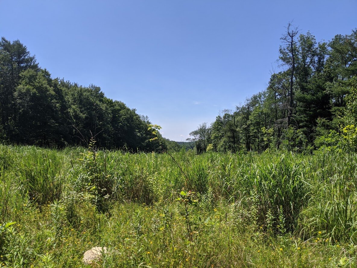
It was a beautiful, clear summer day!

The Cabin Trail veers right from Cherry Ridge Road and heads south through Pequannock-Newark Watershed to eventually join Cannistear Road.

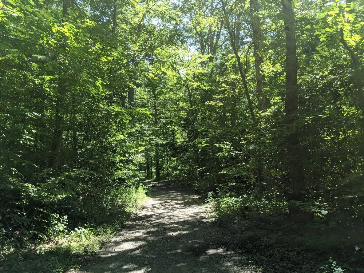
Through Waywayanda, the trail is a wide, well traveled woods road that leads to the pipeline. Unauthorized vehicles are deterred from entering Cherry Ridge Road through a series of gates.

Turkey Ridge trail appears on the east side of Cabin Trail. You know what's weird about this area? The smell. It smells like an old wooden home that has been deteriorating in one tine patch of land just north of this trail junction. My parents made me go to all kinds of historical sites as a kid, and the one thing you never forget is the rotten smell of decaying wood. Not like decaying tree, but wood used for building. I can't explain it. If you've ever visited the soldier huts at Jockey Hollow... it's THAT smell.

If you follow the Turkey Ridge trail (green blaze), you'll eventually come upon the Tombstone trail (unmarked), where at the end, near the top of the hill, you'll find the Utter cemetery.

The Dog was very happy to be hiking through Waywayanda. He liked the part of the woods road that had deep ruts with huge puddles, because he enjoyed watching the frogs leap all around him in and out of the water. (and did you notice his new collar??)

The is an example of the stone fences that are everywhere on Cabin Trail.

Midway through the Waywayanda section of Cabin Trail, you'll find a gate. The trail to the right joins right back up with the trail around the gate.

Deeply forested, it's tough to see any ruins here other than the stone fences. There are some plots that kind of look like old homes that have been filed in, but compared to some of the other ruins in nearby areas of Pequannock-Newark Watershed, these ruins are near to impossible to find.

The little frogs loved the puddles on the woods road. Be sure to wear hiking boots - it's tough to get around these road-width puddles, which are home to frogs and mosquitoes alike!

This little Northern Green Frog has a distinct green head and bronze body, whereas the rest of his brethren tended to be completely bronze.... if you can find him in the picture!

The pipeline stretches through Waywayanda, and leaves us with breathtaking views of the surrounding area.

The Dog. He was hot. He drank a lot of water.

Bird's-foot trefoil

Pearly Crescent butterfly

More of Jersey's signature huge glacial rock. The Watershed is full of this stuff.

The trail changes once you cross over into the watershed. It's still a wide woods road, but overgrown with less travel. The Dog's growing concern over the gunshots eventually had us turning back before we reached our planned destination.

The trail is thatta' way!

Back to the pipeline... this unmarked road, used primarily by mountain bikers, leads up to where Rattlesnake, Tombstone and Pines trails converge. The cemetery is at the top.

Tennessee Gas Pipeline signage and electrical box.

Cabin Trail is marked yellow in Waywayanda, but is unmarked on the 2017 NY/NJ Trail Conservancy map.

The Dog looks longingly back at the park as we drove away. He didn't want to leave! I had to stop to take a picture of it because I thought it was so funny!