
Where am I going?
Highlight Hiker Blog
November 5, 2020
Abram S. Hewitt State Forest, State Line Trail, NJ through Sterling Forest, Appalachian Trail Corridor, NY
The best part about solo hiking is the opportunity to learn about yourself. There aren’t any distractions (unless you create them), and the only person to talk is… well… YOU. And the trees, and birds, and the ancient rock if you believe that they listen. But the point here is that it’s an opportunity to look deeper at yourself without distraction. And since you’re challenging the better part of yourself physically, there ain’t nowhere for that mental energy to hide. You have to be your own trusted climbing partner, confidant, cheering squad, therapist, and team coach. Out here, there is no one to help you but your will and whatever you have in your backpack. You learn to be resilient.
So it’s fitting, I think, that the second to last hike that I had to complete on the NY/NJ Trail Conference map #116 came with using every -ism I had in my toolbox to get me through. It was a great challenge, and I was genuinely afraid a few times. But these little mantras got me through. So here are my top 5 what I like to call “Highlight-isms” that I’d like to share with you, in no particular order.
#1. “It doesn’t matter when you get there, as long as you get there.”
So often hikers race to get to the end. Long distance hikers, especially. There are people who seek out the FKT, and I just wonder… why? You miss all the good stuff! The tale is told within the making of the story, and when you’re rushing through it, essential details are missed. Slow down, take your time. Stop and listen. I used to get upset with myself when I would get passed (usually uphill) by other hikers… they’d be smiling and enjoying themselves, where I’d be huffing and puffing and red-faced. I used to be upset by my limitations: my age, my level of fitness, my fear of injury on poor terrain. But now I just pull over to the side and let them pass with a smile myself. I’ve come to know that my journey is my own, and I like it the way it is. I’m such a curious human that I stop along the way to take photos, or research a tree… to find out the historical significance of a place, or to know how glacial erosion works. Some people just aren’t into that. And that’s ok. They want to get in and get out… I want an experience. I want to be able to remember each unique trail. We all end up back at the parking lot eventually. Who cares if I’m slow and stop up the hill? It gives me an opportunity to look up.
#2. “You can do more than you think you can do.”
This is a Highlight-ism that started in the theater. I started acting when I was 5. I spent my life on the stage and it was the foundation for the person I am today. When I moved into directing, I found that actors were far too nervous about dropping their script. For some it was a security blanket and they wouldn’t put it down long after they should have. To those actors I would always say, “You know more than you think you do.” The only way to learn, and to memorize particularly, is to stop worrying and just do. First of all, so what! You made a mistake. That’s what rehearsal is for! But when you drop a line, what do you do? You clench up. Your muscles seize. You freeze. Your brain comes to a screeching halt. My thought is when you’re struggling for a line; relax. Once you stop worrying, BOOM! The line will appear. It works so well that I translated that philosophy to hiking. For many hundreds of miles I didn’t feel like a “real” hiker. I wasn’t hiking long distances and I didn’t know anything about navigation or boot fit or what I needed in a backpack. It took a lot of trial and error (mainly error) to know what is purposeful on the trail and I’ll tell you the secret to what it is. The most important thing to pack for every trail is your mentality. Your best ‘I can accomplish whatever I set my mind to doing’ attitude. Call it stubbornness, or persistence, bull headedness… I prefer tenacity myself… but it’s what drives me to keep going. Push up that hill, climb up that ladder, jump across those boulders, cross that stream on a log, not let your fear of heights make you miss that photo op. On this hike, my biggest challenge was to push through some sketchy rock climbing (and thank god I had some exposure to climbing thanks to my amazing sister). I needed to summon the courage to haul my big old round butt across (yeah, not up but across) a rock wall. Pulling and pushing and stretching and gripping… and breathing, breathing, breathing. I was terrified but I did it. Because I knew I would. And if I doubted myself I said, “C’mon Highlight! You can do more than you think you can do! STOP DOUBTING AND START DOING!” and y’know what? It worked.
#3. “Keep walking. Don’t stop. Don’t think. Just march along.”
This is a good one to pull out of the toolbox when I’m tired…. and/or I didn’t bring enough water... and/or if I’m plain old miserable... and/or if I am behind on time because I stopped to do that research-y thing that I do. It’s a lot like the aforementioned bull headedness/tenacity-thing but whereas “You can do more than you think you can do” is reserved for situations when I am afraid that I can’t accomplish a task, this mantra is saved for the times when I just don’t WANT to do the task. There’s no quittin’ in the middle of the forest, peoples. You need to keep going. Regardless the pain of injury, the exhaustion of elevation, the plantar fasciitis, the thirst or hunger or both. Personally, I like snacks and caffeine to keep myself going, but when those can’t be the solution it’s all about mind over matter. And I win that game by staying in motion. Mostly because if I stop, defeating thoughts will creep in and when you’re a mile or more from your trail head, there is no room for self-doubt. I need to keep an eye on the trail, or the terrain, or the map, or the time and just. keep. moving.
#4. “If you don’t know what it is, don’t touch it”
Ah yes. That old adage. I learned it while scuba diving. But it’s true. And in the woods there a lot of things you have no business touching. Especially we curious humans who feel that part of the learning process means tactile-y exploring the world around you. Think I’m kidding…? Beyond rattlesnakes, bears, and the common poison ivy, oak and sumac, there are plenty of other species that offer a kiss of illness or even death. A few of them are: larkspur, lupines, water hemlock, locoweed (for my hippie friends, relax: that has nothing to do with pot), halogeton, amanita phalloides, amanita bisporigera, morels, false morels, shaggy mane, sulphur shelf… you get the picture. Trust me: it’s easier to just not touch it.
#5. “The bigger the challenge, the bigger the reward.”
Y’allsies have read this one from me countless times. It’s the tried and true. It’s timeless, ageless, perfect for every situation, worthy of all struggles big and small. THERE IS ALWAYS A REWARD. Use your tenacity to get past that hurdle you face and get yours! You can do it. I believe in you.
Needless to say, State Line and the AT Corridor were tough. I don’t care what anybody says, that is a tough climb with tough terrain and some hairy sections. It’s 6.5 miles of perfect. It includes the highest point on the AT through New York at 1433’. Further nobo, it’s where I introduced myself to my vulture friend in the cover photo. I’m not a huge fan of heights… they makes me feel dizzy… so this out-and-back hike pushed me in the right direction to both test my fear and conquer it.
And now, there is only one monstro hike left on map #116!!! How should I reward myself when it is complete??? Oooh! So many options! (Highlight drifts off thinking about gear she needs)
=ahem= Back to the task at hand! It was a great day. The best part of this adventure is the story found in the photo captions, so please enjoy!

The parking lot is tucked high above Greenwood Lake Marina. You may not park at the marina itself. You'll see signage pointing you to the correct lot.

I'd say that 12 cars can squeeze into the lot, but it comfortably fits 10. It is a popular place to hike, so arrive early or late for the best chance to park here. There aren't any other good options nearby for parking to reach the State Line trail.

The Welcome Kioask is meh... same as the others in this general area. Secretly, I wish this had a bench like the trail heads in Newark-Pequannock Watershed.

Here's another revision map. According to this map, the new pink blaze is complete, so I do have one more hike in here to complete. yay....???

There is a hearty brook that flows into Greenwood Lake but it is not drawn on the map, nor is it named, nor does it show an origin point so I can't give you any further info right now, but you'll see plenty of pictures of it!!

After many days of rain, the bottom of the trail was saturated from run-off from the unnamed brook.

Large boulders, downed trees, and slippery leaves made the brook crossings slow, but I stopped for photos and video so what did I care??

The brook, even if it is seasonal, is substantial. I am surprised it gets no credit on the map.

At the lower part of the climb the temps were cooler, but the sunlight (and the climbing) kept me nice and warm.

More of the brook, and at this particular spot the trail had flooded. But those clever trail maintainers created a great stone path (no wobblestones) across it.

The rocks were so pretty and diverse in color, size and shape... how could I resist a photo?

Typical rhododendrons of the Appalachian mountain range.
I loved this big boulder!! See the strings of quartz that bulge out from it? It's just so beautiful!

Imma go out on a limb and guess that this is golden rod... but I really don't know because I took a crappy picture. If you know what it is, will you email me? Thanks!

Still climbing. In fact, this climb begins at around 675' and eventually hits the highest point of 1433', so most of my photos will be of me looking up! But can you see the difficulty in the terrain? Boulders larger than the size of your feet dot the trail and are covered in a thick blanket of downed leaves. I don't know how other hikers were marching up through this stuff. I dread a twisted, or pulled whatever and took my time.

The greenery is still clinging to the last long days of warm weather!

These fairy doors are found along the trails of Abram S. Hewitt State Forest. There is one near each entry point (except Longhouse Road/AT)

Still hoisting myself up the mountain!

Now this is for sure golden rod! It's seeing the last of the sun for the season.

The view really starts to come into shape a few hundred feet up. During the flush summer months, you probably wouldn't see this view at all for the ascent or descent.

Love the markers. Not so keen on the constant climb.

If you look closely, you'll see this rock wall is covered in moss. That moss is caused from the runoff that creates the brook that empties into Greenwood Lake. The whole side of the mountain was a waterfall. I wish I could have captured it better for you to see. It was fantastic!
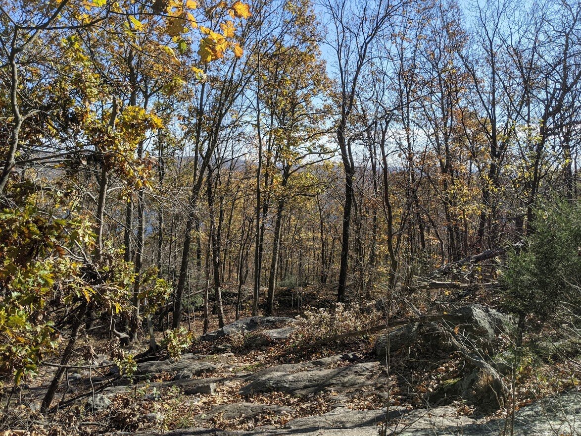
Another hundred feet of climb and the view starts to spread out a bit more. That was the great thing about stopping to catch my breath: I turned around and saw this! If I hadn't stopped, my back would have been to it the entire climb.

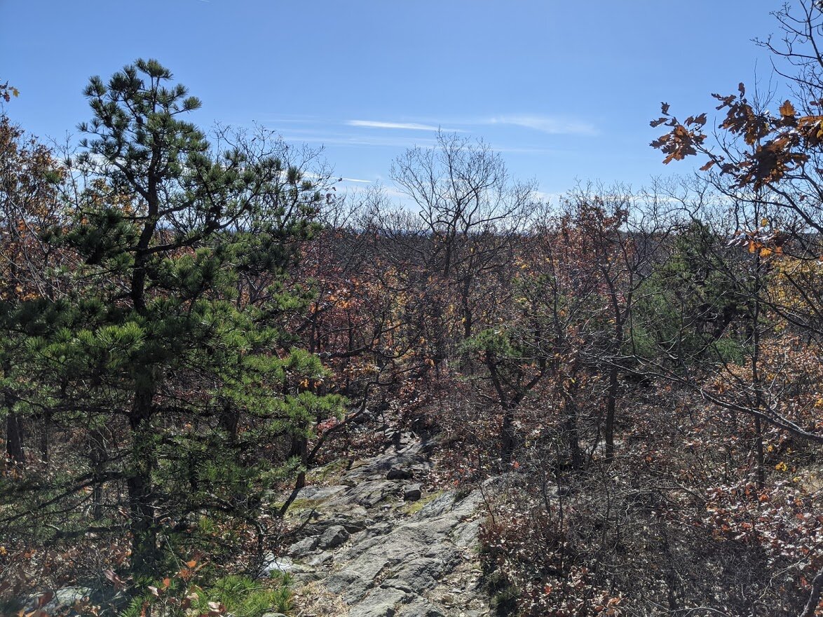
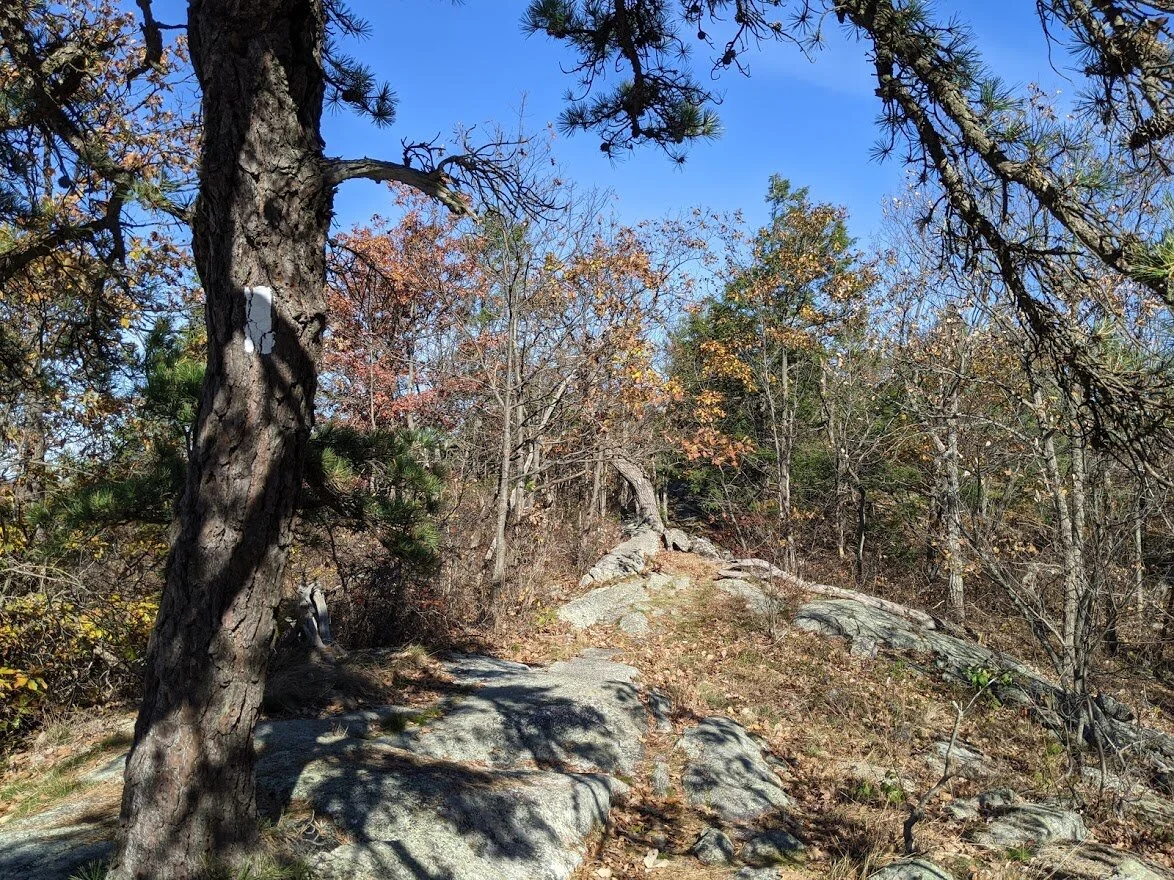
Yep. That's the trail.

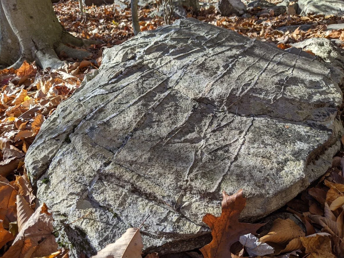
That is straight up glacial striation, folks!!! The best example I've found! I was totally fan girl-ing.

There's the boulder that most likely made the deep gouges (striations) millions of years ago. Geology is awesome.

A little more than halfway up the climb, and I crossed the scenic Ernest Walker trail. But I was still headed up on the State Line, and into the toughest section of this trail.

The State Line trail is pretty cool in that the rock formations get larger the higher you go until you reach the smooth top (it is not a bald, however). See the smooth rock in the background? That's not the top.

Look at the size of that oak leaf!! WHAT...?!?! That's a good, healthy tree!

Mmmnn, mmmmnn! Look at the view from 1200' feet!

The sun glistened through the trees and what is left of autumn colors.

Yep. That's the trail. And I still have more climbing before I join the AT. After this point, the trail gets steep and there are more scrambles. They are worse scrambles, believe me, but it's worth noting that they were easier to get up than to get down.
You can tell I'm near the top not just by the view, but by the trees. Smaller, heartier, able to withstand higher winds and harsher conditions, the trees change at higher elevations.

They also sprout from peculiar places...

Almost there... !!

YES!!! The State Line trail head!! After 600+ vertical feet of climbing!

Hello, Appalachian Trail. You beautiful thing, you! We meet again. (Highlight raises eyebrows up and down)
The ridge walk here is interspersed in short forests of mixed woods. The climbing isn't over quite yet, though. I'm headed to Prospect Rock at 1,433'.

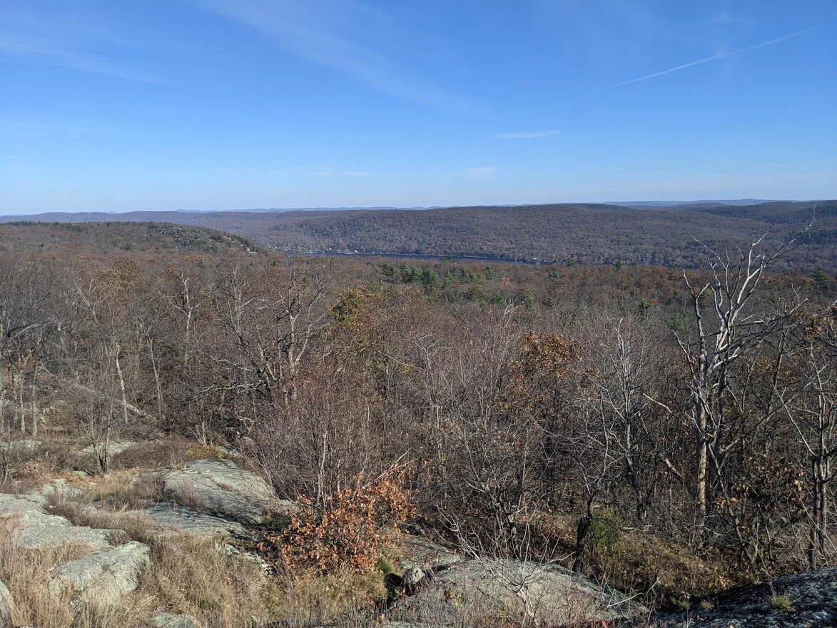
I've been climbing up the mountain in a westernly direction. At the top, I finally got a view to the west!

The AT snakes along this spine of Bellvale Mountain.

There are teaser views leading up to Prospect Rock, and this is one of them!

Would'ja look at that! I'm crossing my first state line on the AT!! I'm looking forward to coming back to this spot on my thru-hike. One day, my pet. One day.

JERSEY! JERSEY! JERSEY! lol

Fan girl-ing some more!! SO COOL!

I was go glad for at least the few feet of trail where I didn't have to carefully watch my step. Finally I could look straight ahead!

As Prospect Rock (the highest point on the AT in New York) comes closer, the terrain really changes. Bellvale Mountain is clearly eroded by wind and rain, and the trees fall away from the trail as the rock is not hospitable for large growth.

Almost to Prospect Rock! The view is going to be spectacular!


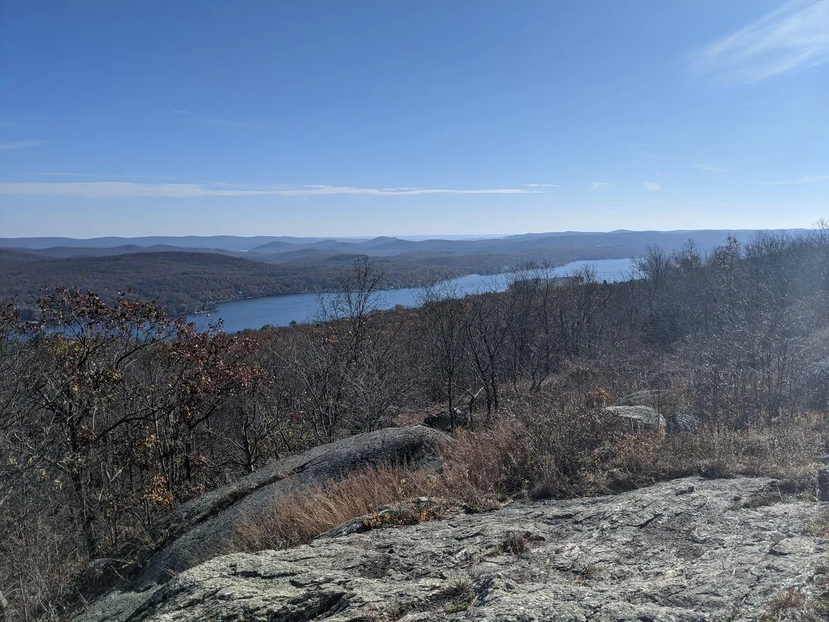
Looking back from the direction whence I came, I can see Greenwood Lake in a new season.

I had to hang back from the best view, since there was a couple there and none of us were wearing masks. This was my first view from Prospect Rock.

The highest point always comes with a marker!
That's not even the good viewpoint, either. Isn't it worth the effort?? I DID THAT!

Gorgeous. The perfect reward after a long climb. But the climbing and effort aren't over yet!

Check it out: quartz and rose quartz within a foot of each other!

So, check this out... I passed by the couple and started the next portion of my intended route, but I was wavering on whether or not I wanted to continue. My plan was to stop at the view and have a long break with a PB sandwich. But the couple wouldn't leave, so I pressed on.

But I got to this point and I realized that was a mistake. I wasn't entirely sure what was in store of me on the nobo journey and I really needed that break, so at this point I turned and headed back.

The couple left on my return. And this was my view for the next 15 minutes.

Greenwood Lake is below. This is looking in a south-eastern direction.

Looking in a north-eastern direction.

Further north still.

These endless fall afternoons where the sun stretches long and lean for hours also means there isn't much avoiding flare. But the view is still pretty!
One last lingering look. I'll pass by here on my way back to NJ and Abram S. Hewitt State Forest, but I won't stay long.

After the view, it is a long time until I take out my camera again. It's the terrain. I'm descending for what seems like an eternity through a stream bed, which means slippery and rocky and rooty. There was a rock outcropping where I nearly slid off the rock and it spooked me. It took me at least a mile of walking to get over that scare. But here I had come to another unnamed but thriving brook. It's origin is on the map, but an also unnamed lake high in the woods.

This brook crossing was not as well maintained as the one at 800'. It took a little more planning to navigate my way across.

Swampy and not enough elevation for the water to rush in the elevation above my crossing.

Looking back at the crossing. It was pretty deep, believe it or not!

Yep. That's the trail. It gets a bit dicey in here as you make your way to the next scenic viewpoint. Lots of hand-over hand climbing for we short people!

I don't know how anyone can think this is easy. Even if you've been on tougher terrain, this still ain't easy!
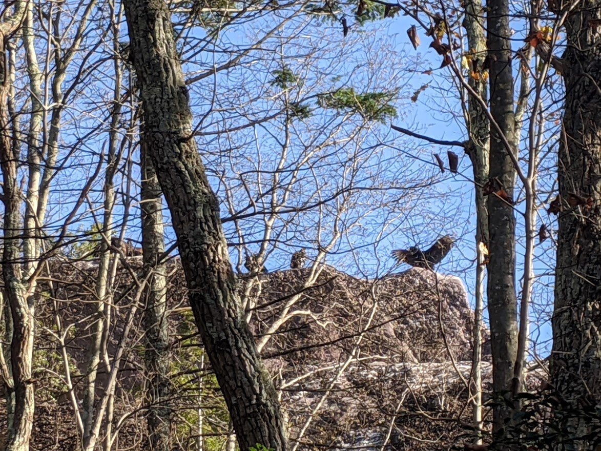
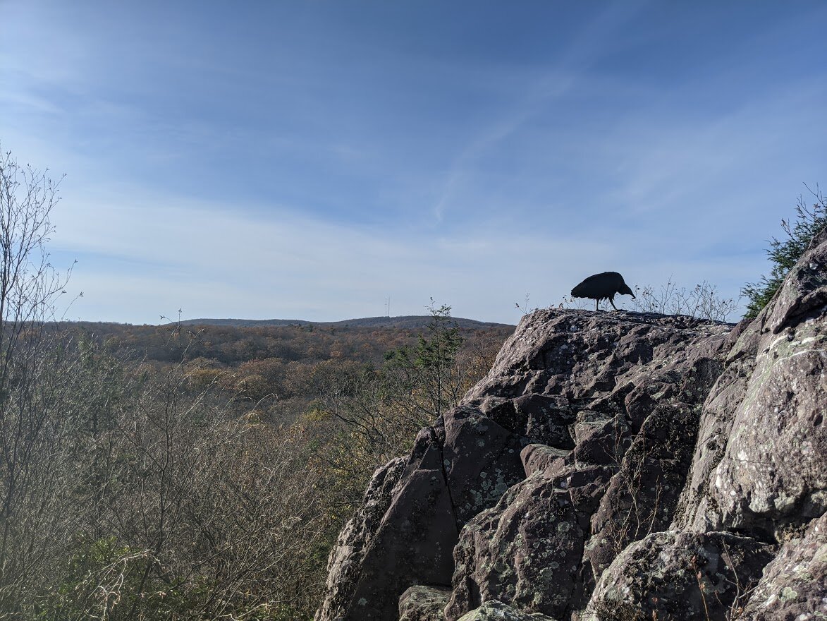
I came to a high point where the vultures nested (I get that there are mountains as high as 6,000 feet on the AT, and that 1,300' ain't no thang but a chicken wang... but this is as high as it gets in my area, and I am easily impressed).

To get to the vultures, I first had to cross this section of trail. More like, I had to talk myself into leaping from one boulder to the next because I was short enough that I couldn't actually step from one to the other. Buuut... I did it easily.

Oh yeah, and did I mention that I had to climb rungs? Going up was a breeze. Getting down took some courage.

There's my buddy!!! I called her Sharon. I have NO idea whether it's a male or female. She just felt like a 'Sharon' to me.

There must have been 6 different vultures sunning themselves on the rock. I startled all of them but Sharon. They waited patiently for me to leave in the sky above.

This is why I do it. It was me, my tenacity, the trees, and that view!

Greenwood Lake in the distance. I think this was the best view of the day. Partly because of the effort to get there, and partly because it's just a damn good view.

See the third bump in the ridgeline? That's where I turned around (due to time constraints) on September 11. I kissed the rock and then headed back toward the State Line trail and the parking lot.

Another long look. I can't believe I did it!

This is what it really looks like at 1300'.

One last breathtaker... although my breath may have been taken away by the fear of knowing I had to get DOWN the same way I came UP.

Goodbye, Sharon. Wherever you are. May we meet again!

So, this really amazing thing happened when I was walking back. Remember how I told you I didn't take photos for a mile or so? This is that area. The cool thing (literally) is that I could feel the temperature change due to the rock. It was even more intense when there were rocks walls on both sides of me.

Yep. That's the trail.

Alright... so this is the place where I slipped on the way down. The trail is marked across the rock, but it isn't the way to go. There was a better route away from the markers, I just couldn't see it from above. The secondary route is to the right of this photo. It meant a bit of bouldering sideways, but it was such a good decision to find a new route that I actually gave the slippery route the finger once I made it up.

This is the view from the top of Mt. Slippery Rock.

LOVE THOSE RIDGE WALKS!!

Goodbye, Prospect Rock and the NY section of the AT! Until later...

I consciously took zero pictures on my way down the mountain. After climbing over 2,400' and with nearly 90 photos already taken, I chugged my way down without looking at much other than the terrain. I probably should have busted out the trekking poles for the descent, but I didn't. If you're a trekking pole hiker (which I'm really not), you'll for sure want them for this hike. This was the only photo I took on my way down. And I was approximately two-tenths of a mile from the parking lot.

Before this hike....

... after this hike. I have completed all but ONE marked trail on NY/NJ Trail Conference map #116 (2017 edition). There IS a new trail that was just blazed, but it isn't on this map. I am debating doing it now to check it off my list.