
Where am I going?

Highlight Hiker Blog
May 2, 2021
Long Pond Ironworks
Highlands Trail and Jennings Hollow
Ah, yes. It was May 2nd. It was a weird weather day. It started out sunny and hot. Then it got overcast and windy. Then it rained. Then it was overcast and windy. Then it was sunny and hot again. All in the span of my (approximately) 8 miles of hiking.
I knew the bugs were out. Little gnats and mosquitos and mayflies and no-see-ums all trying to love me to death be flying into my eyesearsnosemouth, so why I decided to hike the Highlands Trail up through Long Pond Ironworks during mud season is beyond me.
I did this same trail in late summer about 3 years ago and the bugs were so bad I turned around and went home before getting 1/2 way through my intended route. I wrote “BUGS!” on my map with a giant circle. The bugs here are so bad that I swear they waiting to swarm your head even in frigid winter weather.
So word to the wise: if you decide to hike this route, get a bug net and a hat. Take them with you. Use them when the pesky little buggers become annoying. You’ll be the envy of all who pass you, headed back down the trail unable to withstand the seething packs of flying insects that just want to be near you at all times. I want you to enjoy this trail so much that I’ve included a link to my favorite bug net in the “Explore It” button.
I was armed and ready for them this time! Those little buggy bastards couldn’t annoy me today! Oh yes! I had two bug nets, one hat, my bamboo shade hoodie from Free Fly Apparel (freakin’ love that thing in the hot humid weather), my rain jacket and lots of water for the long climb. Bring it, you miserable minibeasts! You vexing vermin! You problematic parasites!! DO YOUR WORST.
They tried. I conquered. I didn’t hear them. I wasn’t bothered by them. They couldn’t get into my eyesearsnosemouth. They couldn’t land on my arms. They were impervious to me! HA HA HA! I live to see another day!
And a lot of other hikers stopped me to ask me about my bug net and tell me how clever I was, so that was a nice little boost to the ego.
I crossed the NJ/NY state line and walked as far as the edge of my map, then turned around. Originally I was going to come back the way I had come but where the Highlands trail meets the Lake-to-Lake trail I met the coolest couple who sort of adopted me for the afternoon. They showed me how to make a loop out of my route using a woods road that led to Jennings Hollow and then we all trekked on in the same direction. One thing led to another and we had hiked about 4 miles together, talking the whole time.
Unfortunately I didn’t think to ask their permission to use their names in my blog, so to protect their identity I won’t be using photos of them that reveal their faces.
Honestly, the way I’ve been meeting people these days you would think that I’m beginning to enjoy hiking in groups, but not to worry, dear reader! I am still the lone wolf. I still covet my solitude. I will continue to hike alone to hear my thoughts. It’s strange, though, isn’t it? Sometimes you just have to look at a person/people and you automatically know that you will get along famously. What is that? Is it instinct? Wisdom? Is it some chemical reaction that we have no awareness of? I remember my first year of college, being terrified, not knowing anyone. I walked into the theater for an audition briefing and sitting alone on the other side of the aisle was a young lady. I took one look at her and said, “I want her to be my friend.” and said hello. And it was true! We ended up as roommates, and we’re still friends to this day (despite the fact that we live several states away). What is that THING which makes us feel friend-confident about some and not with others?
Anyway - we had a lovely walk together in the woods and they showed me the beaver pond with it’s huge lodge and gnawed tree trunks. We picked over muddy rocks and slipped in mud together. It was FUN. And if they ever reached out to me and asked me to hike somewhere with them again, I would probably drop everything to make it happen. Of course, that doesn’t mean they felt the same way about me… lol… but y’know… IT’S ALL ABOUT ME so who cares. I’m kidding! I’m kidding!
So if you’re in the mood for a long hike, have a hat and a bug net, like slogging up long climbs, want to cross the state line and would like to see Jennings Hollow, by all means: pick this route! There aren’t a lot of other people and most of the ones you do meet are experienced hikers that you can share your time and stories with!
PS. I hiked all of the Jennings Hollow loop on May 15th, so if you want a blog entry dedicated to just this absolutely stunning trail, keep an eye out for the post over the course of this week!
.
Long Pond Ironworks
Highlands Trail & Jennings Hollow
Total Mileage:
7.75 miles
Total Elevation:
1,434 feet

There is plenty of parking at the Long Pond Ironworks museum. Though the museum is closed due to the covid-19 pandemic, there is a lot of literature about the Ironworks available and the kiosk offers important trail info.

The spur trail from the parking lot is not marked and weaves in and out of high shrubs between the historic buildings.

The Yellow House Cellar Hole is a reminder of the once thriving community that was founded here.

The northernmost edge of Monksville Reservoir is visible from the spur trail, but you'll get a better view of it later.

Monksville Reservoir.

It was a beautiful clear, warm day to start!

This lovely little bench is a great place to sit and reflect, or drop your pack.

The historic homes are boarded up - the windows are just painted on.

This is the Stone Double House. It was a boarding home for the single men who worked the mines and furnace.

The wide woods road next to Stone Double House is your way in to the Highlands trail.

The nearby barn.

Owl's Peak Brook flows beside the Stone Double House and feeds into Monksville Reservoir.

Owl's Peak Brook as it feeds into Monksville Reservoir.

There are some interpretive signs along the way, which help enhance your self-guided tour pamphlet.

A closer look at the ruins of the Company Store.

There is less and less of the furnace each year.

The 2021 remains of the furnace.

There is much more to explore on the grounds of the Ironworks, but I was headed up Big Beech Mountain toward New York. This bridge crosses the Wanaque River, which was central to the success of the iron ore industry here.

Not far from the bridge, the trail divides. If you head north, you'll stay on the Highlands trail. If you head east, you'll be following the newly re-routed Hasenclever trail, which is an historic trail that connects Long Pond Ironworks to Ringwood Manor with interpretive stops along the way. FYI: the Hasenclever trail is not a loop.

This is one of the stops along the Hasenclever trail - the site of the Charcoal House.
A few years ago when I hiked this trail, these signs were brand new. Now they are showing their age.

Somewhere along this wide carriage trail is the location of the former Forge Site, but since it is posted that you are not allowed to wander off the trail, it is not possible to locate it without permission.
Here, the Jennings Hollow trail begins (to the west/on the left). The Highlands (teal blaze) and Hewitt-Butler (blue blaze) continue on toward Big Beech Mountain.

Now access roads, these former carriage roads were the foundation of the mining operation that brought wealth and industry to northern New Jersey.

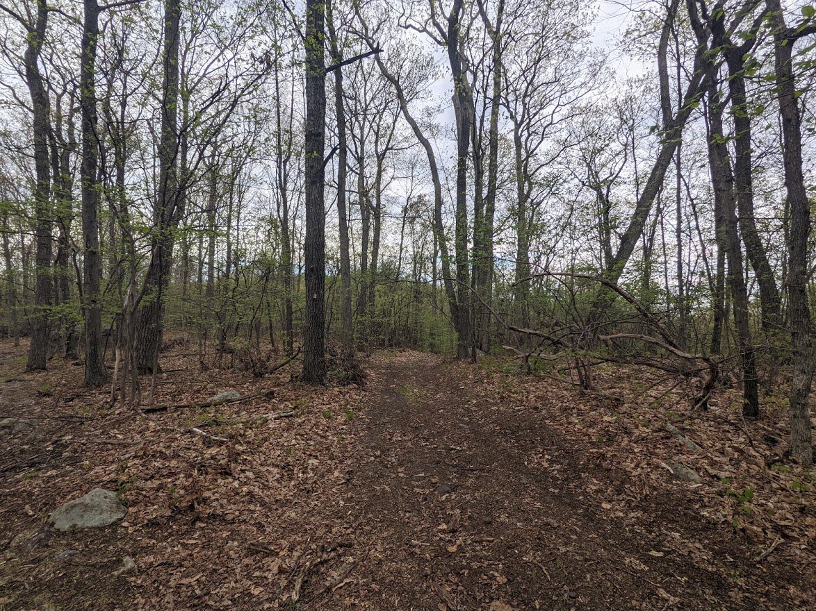
Once you begin the long climb up to Big Beech Mountain, you really don't stop. It's well graded in some areas and steeply graded in others, but most of the time you're moving up in elevation.

The muddy, wet forest produces a lot of bugs, yes, but also a great deal of flora and fauna.

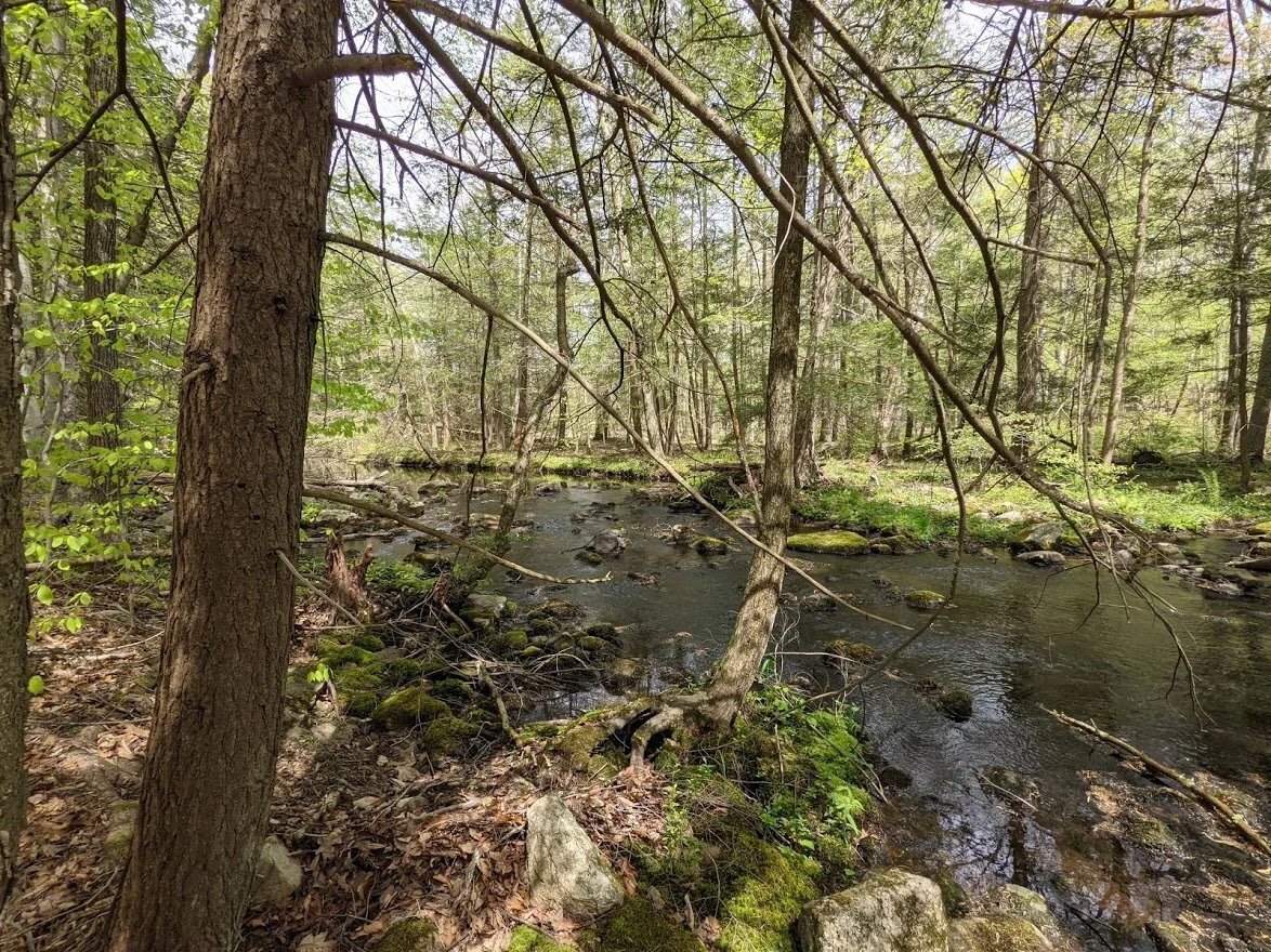
The trail crosses over several unnamed brooks, some seasonal. All are easily crossed.

The wetter the forest floor, the greater the insect population.

It was around this area - before the swamp before the final push up Big Beech Mountain - that I gave up and put on my bug net. Many hikers were coming down the mountain disappointed by the first scenic view, unwilling to continue on because of the insects.

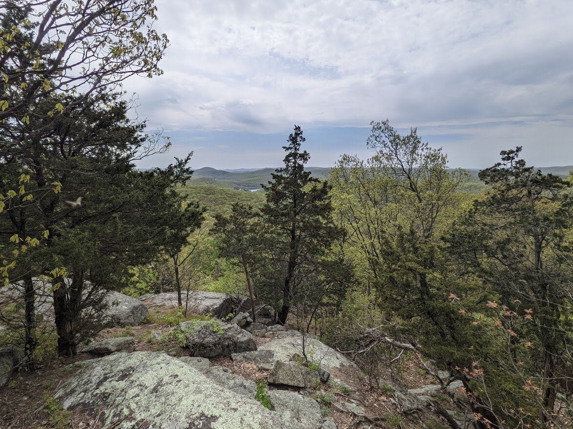
This is the view where some hikers were disappointed. It is not the top of Big Beech Mountain, however. You will continue to climb. But... really... I enjoyed the opportunity to stop, catch my breath and take in the land as far as the eye could see to the east.

A little further there is another view to the west. This one more overgrown than the first. You can see that the sky is starting to fill with clouds.

The clouds quickly gathered and darkened the sun as the wind blew them closer across the sky.
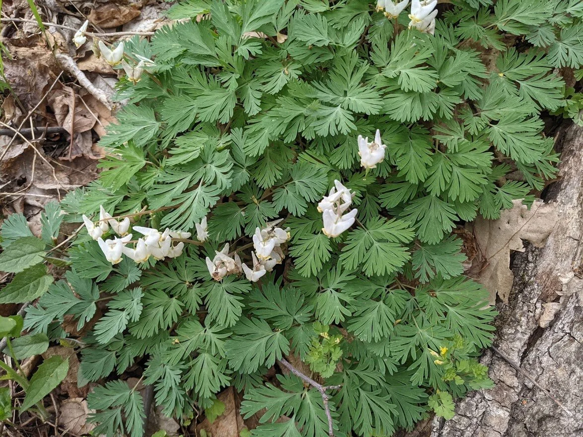
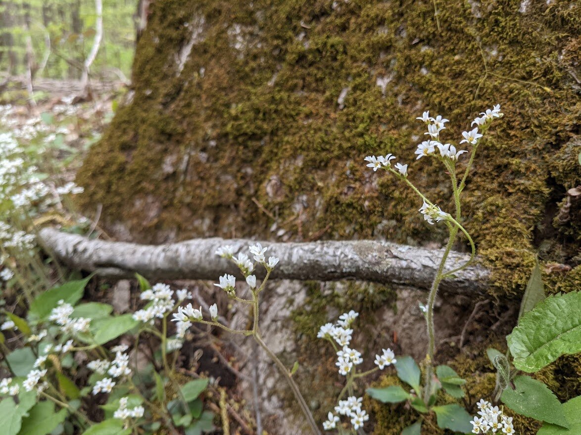
These adorable things are called Dutchman's Breeches. They're so cute! And a good sign of a very healthy ecosystem!

I must have smudged my camera lens... sorry about that! But here I am at the state line! I wasn't sure if it would be posted or not, but to my joy, it was!

I continued north for awhile, and topography clues, continued north on the trail to approximately where it ends on map #115.

Something about crossing a state line on foot is thrilling!

At last I came to the trail intersection in Sterling Forest. This is the trail that leads west to Blue Lake (on the Lake-to-Lake trail)

Signage with distances.

The is the east bound portion of the Lake-to-Lake trail that heads toward Greenwood Lake.

This is the continuation of the Highlands trail.
Once I reached my destination I turned around and intended to go back the way I came, but I was disappointed because I had gotten there a lot earlier than I anticipated and still had plenty of time and energy to continue. That was when I met my hiking buddies. They convinced me to take the Lake-to-Lake trail east to a woods road which would take me to Jennings Hollow.

On this "loop" you weave on and out of NY/NJ a few times.

The rain had stopped by this time and the humidity was thick, but we pressed on over hill and dale, wet and dry creek beds.

When the sky is dark, it changes the color of the forest.

Though you cross Jennings Creek, it will be a bit longer to reach Jennings Hollow spur due to the twisting, turning Lake-to-Lake trail.

The bridge is a helpful crossing over Jennings Creek.

There were a lot of blow downs north along the creek.

Looking south down Jennings Creek.

Something about this area feels very remote and wild, even though you are hiking down a wide woods road.


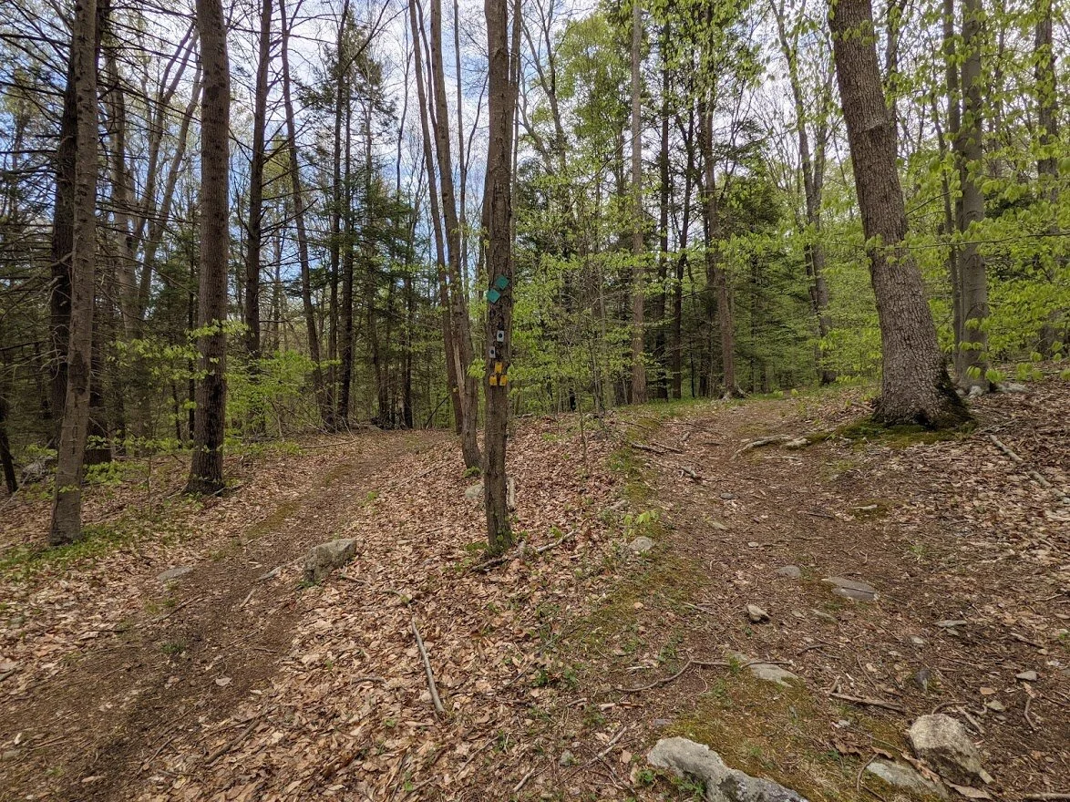
There were quite a few unmarked woods roads in this area.

We came to the trail head for the West Valley trail in Sterling forest, which creates a loop with the Fire Tower trail and the Lake-to-Lake trail. The West Valley leads you north.

On the south side of the West Valley trail is an unmarked woods road which leads south to Jennings Hollow.

It's only a short walk from the Lake-to-Lake trail until you pass the New Jersey state line, and the Jennings Hollow trail (yellow blaze).

There are several seasonal brooks which feed into Jennings Creek. You'll cross a number of them along the western side of the Jennings Hollow loop.

These brooks are easy to hop across on rocks, otherwise the mud at this time of year is deep and slick.

You can see the deep impressions of boots within the mud.

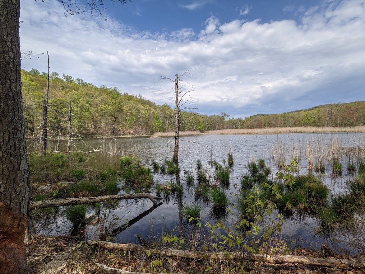
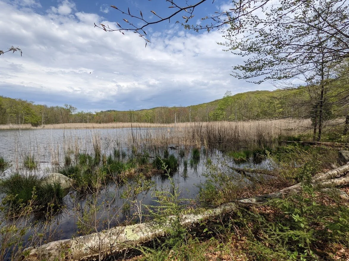
And then, like magic, out of the woods you come to the beaver pond.

It is a beautiful pond teeming with wildlife and birds. I highly recommend anyone who photographs wildlife to come to here at sunrise/dusk.

And such a pretty place to sit nearby and take in nature.

Panoramic!

This is the east-facing view from the west side of the Jennings Hollow trail.

My hiking buddies in action around Jennings Hollow.

You travel south a short distance past the beaver pond to where the map indicates there is a "difficult crossing".
Indeed, Jennings Creek is very wide and picturesque.

Moss covered and magical Jennings Creek.

The "difficult crossing" however, has a rope assist which made it way more fun than it should be!

This was the easiest of the crossings as it had large, stable flat boulders for rock hopping.

The trail then heads back northerly to the beaver pond.

This southern end of the beaver pond is where you see the most evidence of recent beaver activity.
The beaver lodge is relatively close to this end of the pond, but still a very safe distance from the shoreline and predators that wait there.
But the activity at this pond only begins with the obvious beaver lodge. Muskrat, deer, racoons, bears, porcupine and a variety of frogs and birds all rely on this healthy ecosystem.

While it might appear that the beaver gave up on toppling this tree, it is more likely that these are their "dentistry" trees.

Tree bark is park of their diet, and these two trees are clearly delicious!!!

As the path winds away from the pond, you can see the felled trees from beaver activity.

Many of these smaller trees were felled by the beavers, who ate the bark and smaller twigs, and most likely the larger twigs were used for their lodge.

After the trail leaves the hollow, there are obvious sign of previous human occupation.

The stone wall reaches down the path.

The trail crosses through a particularly muddy/boggy/swampy area where it can get dicey without enough rocks to hop. Please avoid walking along the sides of the trail, creating more erosion.

You know you are close to the Highlands trail when you reach this unnamed brook.

It's a short walk downhill on the Highlands trail (teal blaze) back to the bridge crossing the Wanaque River and Long Pond Ironworks museum parking lot.

I believe this home is currently under renovation.

The parking lot from the roadside path.

At the parking lot, there is an historical marker.
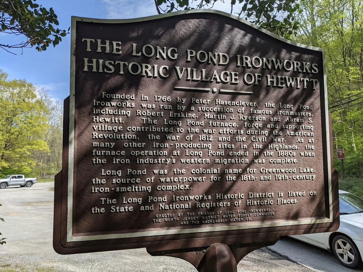
I got a little closer pic in case you wanted to read it.