
Highlight Hiker Blog

August 25, 2021
Pennsylvania
LeHigh Gap Nature Center
Appalachian Trail/Charcoal Trail
First of all, the map you see here is the one I actually used for my hike. It’s a little misshapen, and a little wrinkly, but it’s the best one I have.
Secondly, after tackling LeHigh Mountain, I was very much interested in seeing where I’d climbed from the other side of the gap. My intention was to hike to Devil’s Pulpit. However, I learned when I got there that Devil’s Pulpit had been closed to the public for many years, due to an accidental death at the site. Too bad (in many regards). I’ve seen photos of the view from the Pulpit and they were pretty spectacular. Sometimes while hiking you have to alter your plans spontaneousIy…. this was one of those times. I stuck to my plan to follow the trail up hoping that there would be an alternative scenic view. And there kind of was, though it was off trail and scrambly, and the views were partially obstructed. However, it was cool with a delicate breeze which I so desperately needed after a long slog up.
This particular day I was feeling really slow. I wasn’t sure if it was the climbing or if I was tired coming into it (this was not a planned excursion) but I had to stop on my way up more times than I wanted and it sucked up a lot of my hours on trail.
I am planning a return trip here in summer 2022, where I’ll hike the AT/North Trail loop (no date has been established for this yet) so I hope with a bit of planning, I’ll be much faster.
As per usual, I had dropped the kids off at Dorney Park for the day. I wanted to go back to Fort Franklin Road where I’d hiked on May 30, 2021, but when I got there, the parking lot was packed and there was no room for me! So I changed my plan and headed back over to the Nature Center thinking I could take on Devil’s Pulpit. We see how well that went!
The hike itself is really very nice. The terrain is on the easy side of the gap, where the rocks did not tumble down the side of the mountain in the ice age, so there is less effort, but it is still steep and it still requires a lot of work on the part of the hiker. But once I reached the Appalachian Trail, the climbing ebbed off and became a little easier.
I met a few SOBO thru hikers on my trip but mostly I came across day hikers doing their day hiking thing. Families, individuals, first time hikers, locals enjoying the day, and a trail maintainer who was checking out conditions along the way: it was a great mixed bag of people to sit and breathe and chat with. Everyone was faster than me. EVERY.ONE. I was really dragging ass. Up AND down the mountain.
Once I got off the Appalachian Trail and onto the Charcoal trail, however, I was completely alone. I appreciate the AT. I really do. I would love to hike its entire length one year, but I think the rest of the Nature Center has so much to offer: the vegetation, the views, the trails: they are so beautiful and under appreciated. And the beauty is right there in front of you: not a long distance view across the valley, but the butterfly bush blossoms that you have to push aside, or the pollinators that swerve and dodge your head as you walk looking for a sweet succulent, the ferns and the trees, and the granite topped mountain: it’s right there before your eyes, and your senses. It’s a wonderful place to hike and feel the earth working - a little slice of heaven where you are just a visitor, a spectator in the effort of the season. It’s astonishing.
But then I ran out of time. I couldn’t continue on - I had to head back to the park to pick up the kids. Someone had ridden too many coasters without a break and had a migraine, and they wanted to leave before sundown (which wasn’t the plan). So off I went the way I came as quickly as I could to pick them up.
And then we all stopped for ice cream, which made everyone feel infinitely better. Ice cream: the great healer of all ills. But don’t get me started on ice cream. I love ice cream. I could go on and on about how wonderful ice cream is. It’s ice cream. Great. Now I’m craving ice cream. DAMN YOU, DELICIOUS ICE CREAM!
Pennsylvania, LeHigh Gap Nature Center
Appalachian Trail & Charcoal Trail

The parking area for this section of the AT is right off of the highway by Chain Bridge. It's actually a driveway (I think to a residential home) so you have to respect the rules and only park in the designated area. There is allowance for about 5 - 6 cars.

The trail starts out up Blue Mountain on a hot, exposed stretch.

This is as close as you get to a welcome kiosk at the trail head.

It starts out mild, it ends up wild! Wildly strenuous, that is.

I still can't believe I climbed to the top of that monster!

The views are good, even at such a low elevation. They'll get better, I promise.

The Woodpecker trail leads down Blue Mountain to the LeHigh Gap Nature Center, where there is ample parking. It just adds more time to your climb by starting there.

This is the George W. Outerbridge Shelter along the AT. It has a firepit, and some logs to sit on. There are also some tent sites nearby.
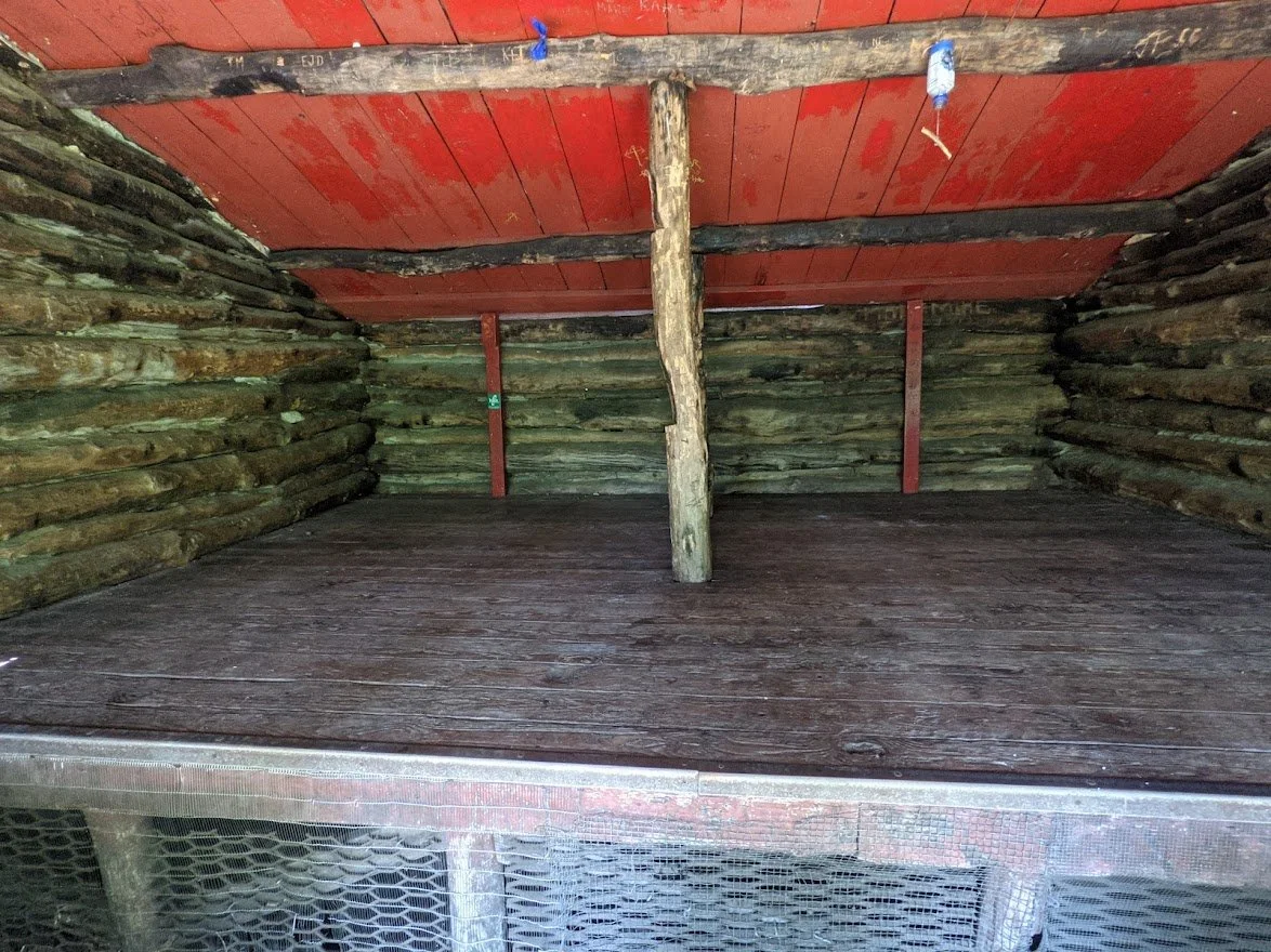
The interior of the George W. Outerbridge shelter

Signage at the George W. Outerbridge shelter

The point where I turned off the AT to head further up the Charcoal Trail to the location of the former Devil's Pulpit scenice viewpoint

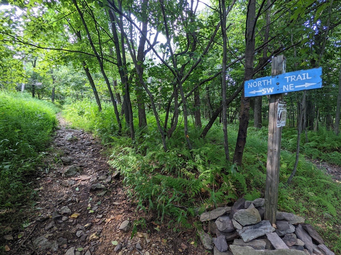
I was told by all of the locals that the North Trail is THE trail to hike here: the views being better than those from atop LeHigh Mountain. I was originally going to hike it, but the kids called me away before I had the chance.

IT'S CLOSED. WAH WAH.

Using my GPS, this is a peek a boo view not far from the former Devil's Pulpit trail. It has grown in and you can not pass through. And I wouldn't. It's my understanding that the drop off is quite treacherous and if you can't see it through the thicket then.... yikes.

You can, however, imagine how incredible the view must be from that spot. Too bad.

The rock from the top of Blue Mountain had cascaded down to the Charcoal trail and created a passage to a viewpoint that is not official.

I sat here for a long long time. It was breezy and cool compared to the rest of the trail. And I needed a place to sit in the shade and cool off.

Lot of bumblebees and butterflies here and the view was stunning

And you're higher than LeHigh Mountain, so the views are sweeping in every direction

I fell in love with this spot quickly and surely

Lots of picture

The butterfly bush was abundant

AS was the snakeroot

A look up at Blue Mountain

I know it's hard to see, but a rock had come out of the earth and a tiny little trickle of water ran into the hole where the rock once was, creating a little pool. I thought it was fascinating. Nerd.

There is a natural spring along the Appalachian Trail which serves as a water source for thru hikers. In fact, when I came upon it, there were 3 SOBO hikers filling up at the spring. So I took a picture of the signage there, and not the hikers.

Climbing back down and enjoying the views

I was so hot. It was a sweltering 90+ degree day

But it was such a rewarding hike I didn't mind. There was ICE CREAM in my future!