
Where am I going?

Highlight Hiker Blog
May 9, 2021
MOTHER’S DAY
The Appalachian Trail
Sterling Forest, NY
Mother’s Day. As a Mom I covet Mother’s Day. We’ve gotten past the need for brunch of ice cream sundaes. No. We’re at the phase now in my family where if I didn’t go hiking, they would check me for fever. Yes. Mother’s Day. The day when all Mothers should be able to do whatever it is they want without guilt! That includes everything from eating ice cream sundaes to jumping up and down on a trampoline (and if you’re a Mom you probably know why that’s funny. But we’ll keep that secret to ourselves).
Mother’s Day 2021 was perfect: marvelously sunny and warm with a cool breeze. Where else would I want to go hiking, then, but the Appalachian Trail? I had made up my mind the night before to see more of my favorite long distance trail rather than complete a trail on map #115. While I am desperate to complete Norvin Green State Forest, this was MY day, so I wanted to go where my heart (and my boots) belong: the Appalachian Trail.
I love the AT. I just love it. The romance of adventure and hardship and beauty and simplicity all wrapped up into 2,193.1 miles…? =sigh= Some people feel that way about a Jane Austen novel… I feel that way about long distance hiking. Some day I will walk it’s length in one season, but for now I will content myself with sections along its length as I complete the maps in Northern NJ. The Thru-Hikers I meet always say, “Don’t wait too long!” to which I reply, “I’m waiting for my children to graduate. I have so little time left with them until they fly out of the nest, and they are worth that time. So for now, I choose my wonderful family over the trail.”
But one day. One day.
One thing I’ve noticed about the AT in these here parts is that when it’s easy, it’s delightfully easy, but when it’s tough, it is rough and gritty and means business. There doesn’t seem to be much in-between. In this section the trail can be so sweet and easy that you could skip along it with a basket full of apples. But then there comes Eastern Pinnacle and Cat Rocks, where you need both hands to scramble and climb and the apples would have been lost to the gaping crevasse below. It isn’t monstrously difficult - shoot, if I can do it, you can too! But if you’re like me and get a little woozy standing on a precipice looking down upon a sea of treetops with granite walls below you, you might have to convince yourself that you’re ok getting up and down Cat Rocks. Which I did! There’s photo evidence below to prove it! I didn’t take the blue blaze… well, I did on the way back but that’s because I was really, really late for my Mother’s Day brunch of ice cream sundaes.
The Appalachian Trail
Sterling Forest, Warwick, NY
Total Mileage:
6.37 miles
Total Elevation:
1,125 feet

It feels like home!

I've photographed this kiosk before... this is the main parking area at the intersection of Striper Road and 17A.

In case you need a map...

Yes yes yes!

I had just started out when I heard rustling just up ahead.


And there, on Mother's Day, were three deer. I was hoping it was a Momma and her two babies, but I think it was just three ladies. The odd thing was, when I turned around to come back (on the other side of the park) I saw them again.

The AT through this corridor is stunning and simple.

You can make quick work of the trail with such easy terrain.

Living up to it's name of "The Green Tunnel"
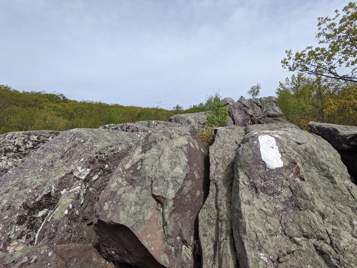
Eastern Pinnacle required just a little bitsy bit of scrambling.

The view from atop Eastern Pinnacle.

The view from atop Eastern Pinnacle.

There was such a nice, cool breeze up here that I decided to sit a spell.

Somewhere down in this valley there was a farm that had peacocks and roosters.

You could hear them from up here.

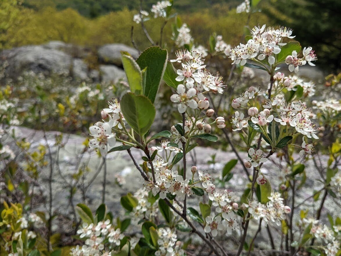
Chokeberry

You should know me by now: this was my favorite part of the trail hiking along the ridge.

Looking back the way I came.

The view from atop Eastern Pinnacle.
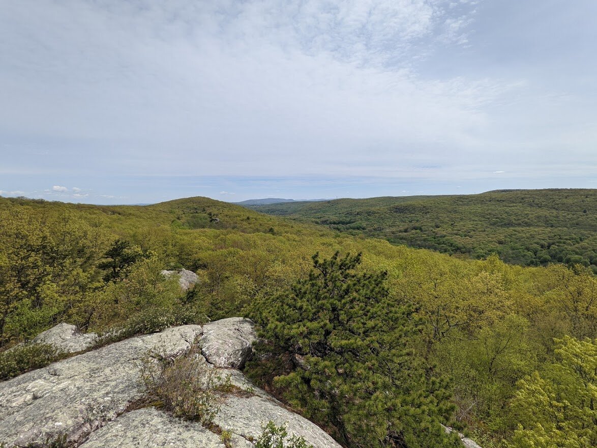
The view from atop Eastern Pinnacle.

The view from atop Eastern Pinnacle.

The view from atop Eastern Pinnacle.

Can't get enough of the view of Eastern Pinnacle and those peacock calls!

Once you get down off the ridge, the elevation maintains itself, even though you hike through some swampy, boggy areas.

But the skunk cabbage is out, so it makes everything alright!

Then comes Cat Rocks. Getting up was not the problem.

Climbing over was not the problem.

And there was a lot to climb over.

The view from here was spectacular!! Worth the getting up AND the getting down.

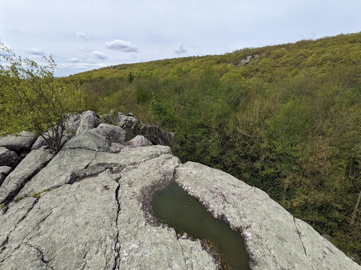

I may have howled from here. I'm not saying.

The getting down was the hard part. It doesn't look hard from this vantage point, but I had to use a few Highlight-isms to get the task done.

The trail then continues on like a little Sunday stroll through the park, as if you hadn't just scrambled up and over Cat Rocks.

And all of a sudden, seemingly out of nowhere comes the blue blaze for Wildcat Shelter.

The trail to Wildcat Shelter, which is maintained by Boy Scout Troop 121.

The Scouts come and provide firewood, and make sure that the shelter is clean and tidy.

There is a picnic table and a fire ring.

Around the shelter you can find water, and a privy and there is a trail that leads to a bus stop.

I thought this was great.

Boy scouts maintain this shelter, so it's a good thing someone graffiti'd it with a penis! WHEW! I'm so glad that's out of the way. SMH. Who does that????

The log book is the more fascinating part of the shelter. I had to take it out and have a look.

This is the singular reason why I didn't make it to Fitzgerald Falls, as intended in the time I had allotted myself to hike this corridor.

Headed back to the trail, the scouts made sure that Thru-Hikers wouldn't get turned around. That was very thoughtful.

I couldn't quite tell if this was an old territory wall, or just a well placed boulder field.

The trail turns east, but there is an unmarked trail that continues on. To where...? Who knows!

It was round about here that I realized that it was time to turn around and head back. Wah wah. I didn't make it to Fitzgerald Falls, which was my original destination.

Coming back to that scramble of rocks that I can't tell was purpose built or not.

Or maybe the rocks were on the trail and maintainers stacked them on the side? It's not really a territory wall...

Meanwhile, back at Cat Rocks....

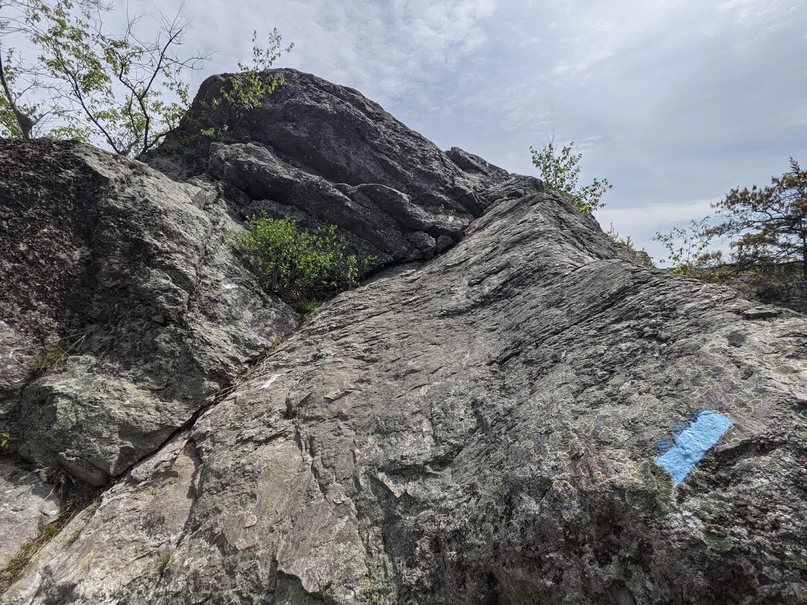
The blue blaze around Cat Rocks is really quick and really easy. In other words: not much fun.

The amazing geological history of our planet on the AT.

In New Jersey a trail like this would be scattered with boulders.

Loves me some skunk cabbage!

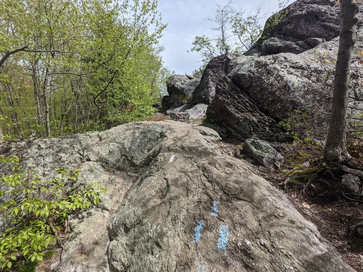
The trail between Cat Rocks and Eastern Pinnacle.

The blue blaze around Eastern Pinnacle.

For the sake of time I took the blue blaze around Eastern Pinnacle, too, but I still heard the peacocks and roosters!

The blue blaze around Eastern Pinnacle is not as nice as Eastern Pinnacle, but filled with great geology. It's a nice short cut for those with mobility issues.

The blue blaze is clearly used quite a bit.

After hiking the Wyanokie Crest trail, I could definitely skip down this section of the AT with a basket of apples!

Headed back to the trail head.

Buttercup

There's 17A!

I was cranking along the trail and got back before I thought I would, so I took the blue blaze to the scenic viewpoint by Bellvale Creamery.
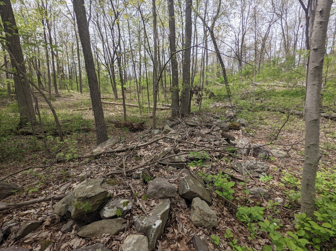
Now THAT is a territory wall!

Dutch settlers lived in this area during the Revolutionary War and most likely took park in the Cannonball Trail.

The scenic view platform in the distance. It is an easy hike from the AT.

This platform was constructed by an Eagle Scout in 1990 and renovated by another Eagle Scout in 2015.

But don't take my word for it!

The view from the platform. Thanks, John and Austin!


The view from the platform. Thanks, John and Austin!

Either it's a big smile, or this person isn't wearing their mask properly! LOL

The spur trail leads directly to the overflow parking lot of Bellvale Creamery.

I did not stop for ice cream as I had ice cream waitin' for me at home!

Crossing 17A isn't for the faint of heart, but leads right back to the parking lot.

The parking lot has enough room for 16 cars.