
Where am I going?
Highlight Hiker Blog
Newark-Pequannock Watershed, Highlands Trail (South)
October 8, 2020
I had planned this hike a few days ago and I was so excited that I slept like crap. But, good as gold, at 7 am I woke up and after some household stuff, was out the door on my way to Cannistear Road and the southern portion of the Highlands trail (teal blaze) through Newark-Pequannock Watershed. I was really excited because this is one of The Big Four: the last (and longest) of the four hikes on NY/NJ Trail Conference map #116 that I have to hike before completing all marked trails on the map! But in addition to that, I was going to hike in two different counties which is always a thrill, even though there are no markers along the trail to let you know when you’ve gone from one to another.
I had a grab-and-go breakfast that I ate on the long drive to the Cannister Road parking lot. I was able to take photos of the end of the Highlands trail from my long walk around Dunker Pond & Mountain and then I started on the 6.5 miler section of the Highlands that is south of Rt-23.
The trail itself starts out pretty rugged but the terrain gets easier the further west you go. It was a really nice trail, although it didn’t have many distinctions such as scenic views or historical landmarks. And I was surprised at how much my pace picked up once I got up and over the first hill, simply due to the terrain.
The only thing that made me sorry about this hike (and believe it or not, it wasn’t the litter on the side of the road, although that was awfully bad) was that the trail had been artificially widened due to illegal ATV activity. Tire tracks were fresh and the deep ruts that were developed made certain portions of this trail really difficult for the hiker. For good reason, it’s illegal to use ATV’s throughout the watershed, and those who do show an immense lack of respect for the watershed, the water supply, the animals who call this area their home, as well as other (legal) trail users.
But I won’t let that ruin the success of my day! Completing this section is a big accomplishment. Just this last March I had only completed the marked trails through the main portion of Waywayanda State Park, and now I’m nearing the end of my goal to hike all of Map #116! I have a few little ragged ends at the corners of the map to complete, but other than that I only have THREE major hikes left: Echo Lake to Stephens Road (N.P Watershed), the State Line Trail to the AT (Abram S Hewitt to the AT corridor), and the AT from NJ-94 to the Waywayanda SP Main Office (Pinwheel Vista). I’ve come so far in such a short amount of time, and my knowledge (historically, geologically, and self-awareness) has grown extensively over the last intense three seasons of hiking. While browsing through the photo journal take a look at the difference in maps from March 2020 to today. It’s a happy day!
NOTE: ALL HIKING WITHIN NEWARK-PEQUANNOCK WATERSHED REQUIRES A PERMIT. THE ANNUAL PERMIT COSTS $14.00 FOR NON-RESIDENTS AND IS CHEAPER THAN THE FINE YOU’LL GET IF CAUGHT HIKING WITHOUT PERMIT. YOU CAN PURCHASE YOUR PERMIT ONLINE OR AT THE WATERSHED OFFICE ON ECHO LAKE ROAD IN WEST MILFORD, NJ. FYI: THE WATERSHED IS REGULARLY PATROLLED BY RANGERS ON WEEKDAYS AND WEEKENDS AND IS FIERCELY PROTECTED BY REGULAR HIKERS WHO WILL REPORT CARS WITHOUT APPROPRIATELY DISPLAYED PERMITS.

Where I was headed today. You can see the Dunker Pond trail already highlighted above Rt-23.

The parking lot on Cannistear Road is huge! 20+ cars could fit here. In my entire career hiking here, I've never seen more than 3, though.

Looking toward Rt-23 from the parking area. There is a pedestrian crosswalk with lighted signal. Hikers are well cared for on Watershed property!
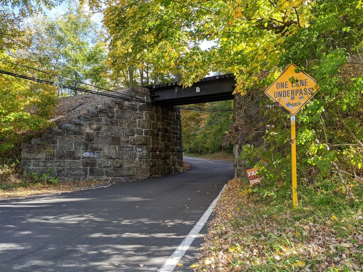
There is an active train line just north of the parking area. Just FYI: it's a single lane overpass, and cars honk as they are about to pass through to let others know they care coming.

This is the same picture I took on the Dunker Pond trail section, but I was so nervous on the side of the road that my picture was blurry.

That's the Dunker Pond trail head at Cannistear Road.

It's a tight squeeze!!

And even though there is a pedestrian signal, crossing Rt-23 is a bit intimidating.

You have to get around the river to get to the trail, and that is best done via the roadway.

The trailhead to Highlands South is right at the bend in the river.

I wish I knew the name of this river. It originates at Cannistear Reservoir and ends at Oak Ridge Reservoir. I think I'll call it Cannistear River for the ease of it.

See? When I said the terrain was rugged to start, I wasn't kidding. I had to skip boulders while climbing 300' in a tenth of a mile.

The boulders were of various sizes and wobbley-ness. I had to be very careful where I was stepping. One slip here and you'll bounce around down the trail like a plinko disc!!
It doesn't get any easier until you top this mountain.

A sad reminder of a loved one lost.
Yep. Still climbing! But at least the morning sun is keeping me cheery about it!

Like so much of this region, signs of Dutch occupation in the 1800's is visible wherever you go. I crisscrossed this property line a number of times.

Looking back at this stone fence, you can appreciate how much work went into the construction of it. It's quite tall and about two feet wide.

Through the trees you can catch glimpses of Oak Ridge Reservoir. I imagine this is a stunning view after the leaves have fallen.

Oak Ridge Reservoir. There are no scenic viewpoints along the trail. This is about as good as it gets!

Yep. That's the trail!

I felt like I was walking along a deep chasm.

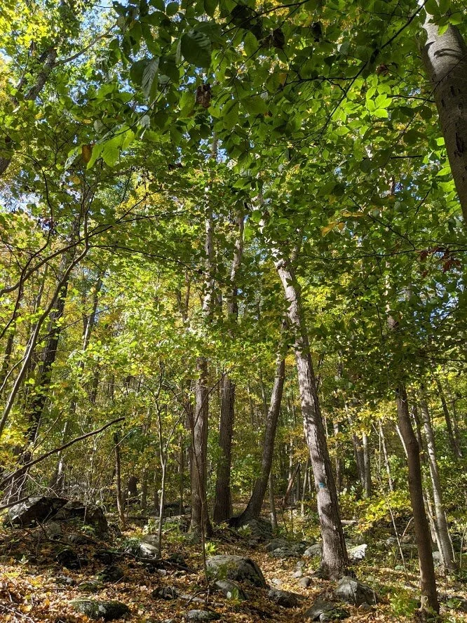
The deeper into the forest you go, the denser the growth. No pioneering occupation in this section of the trail, that's for sure!

Remember how I said I usually find some kind of treasure along the trail? Yeeeeah... that ain't it!

The glacial erratic on this trail is seriously impressive. I couldn't get over these massive specimens!

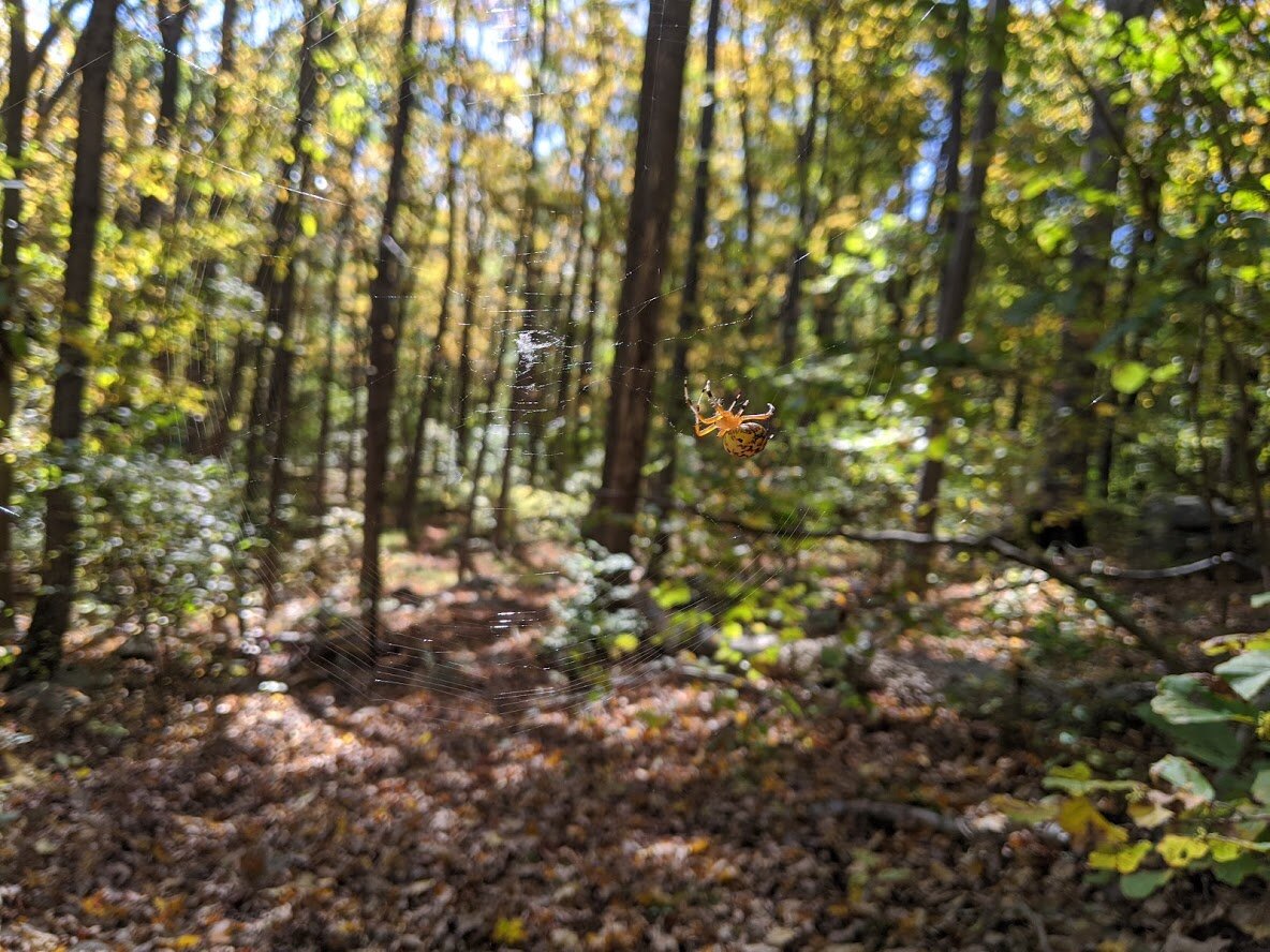
A marbled Orb Spider was spinning a web across the trail. She was as large as my thumb. Since there wasn't a clear marking of the county line, I gave her web the distinction of delineating Sussex County from Morris County.

I made it to the road! Halfway through! I believe this is Stockholm Road? UPDATE: It's Holland Mountain Road. See? Dutch occupation!!!

The road... whatever road it is. Not sure because it isn't listed on map #116. Looking north.

Looking south.

On the way back, I decided (due to an upset stomach) to take a shortcut using an old carriage road. It was a good choice - the road was easy and with very little elevation.

As I closed in on the home stretch, I came across this ancient foundation of a small home just off the trail.

A little different view of the foundation. It is only a few hundred feet away from the power line.

I crossed under the powerline, and then alongside it for a little while. It's weird... the buzzing from the high powered electricity sounds in your ear as you walk by!

Cannister River again!

I was going to come out on Rt-23 west of the parking area and have to do a little side of the road walking. Luckily, there was a wide grassy area, and I was quite a way from the actual road.

Obviously I wasn't the only hiker to take this shortcut - the path was clear all the way up to the road.

Coming out on the road (don't worry - I waited for that car to pass by before I stepped foot on the overpass. No cars or trucks passing on the bridge)

Would'ja look at that!!!

Meanwhile, back at the parking lot.

Map #116 after today's hike!!! What a difference a few months make!

Map #116 on the left on March 30, 2020...