
Where am I going?
Highlight Hiker Blog
November 3, 2020
Newark-Pequannock Watershed, Hanks East to Highlands Trail
I decided to do something completely different on election day 2020 because, quite frankly, it was election day 2020. And the last thing I wanted to do was sit glued to the news all day. I had mailed in my ballot early, so I was free to move about the day as I pleased, so I thought o myself, ‘Self, let’s knock out another one of The Big Four’. “The Big Four” meaning the last and longest trails I have to hike before completing all of the marked trails on NY/NJ Trail Conference map #116. And I decided I would post my photo journal live using different content on both my Facebook page, and my Instagram page. I even had a clever name for the occasion: Step Away from the Day. Huh? Right? That’s pretty good!
Anyway, this hike would be the last in northern portion of the Newark-Pequannock watershed, and while I was super excited to knock out #2 of the “The Big Four”, I was also terrifically sad at the prospect of not hiking in the watershed region for some time. Sure, there are more watershed trails on map #125 and #126, but before I can tackle that one, I have my mind set to complete map #115 first. But I digress.
With all these trails completed, I’ve been asked which watershed hikes are my favorite, and the answer is pretty much “All of them”. But twist my arm… !! I’ll give you my top 5 favorites.
#5. I was quite smitten with the northernmost section of the Bearfort-Waters Clinton (BWC) (yellow blaze). It’s easy and… happy! I maintain my sentiment that I would like to hike it’s entirety rather than to break it into sections one day, preferably in June or July.
#4. Although it was short, Two Brooks (white blaze) captured my heart much the same way the northern section of the BWC did. Every portion of the trail had something to admire. It’s a lovely way to get into the Fire Tower region.
#3. Take a day to hike the entirety of Echo Lake East to Highlands (White blaze to teal blaze) for it’s incredible geology. For me, the placement of these combined trails are tied with Highlands Trail at Dunker Pond for positions #2 & #3. They both were wonderful challenges with even better rewards. I’ll forever be flipping and flopping about which of these two takes the top position for a lifetime!
#2. The Highlands Trail at Dunker Pond (Teal blaze) is spectacular, and with all its ups and downs at steep elevations, it is noteworthy for it’s vigorous physicality when hiked as an out-and-back… it is also noteworthy for the many spider webs conveniently placed at face height. Hikers looking to train climbing a few thousand feet in a short distance will appreciate this trail as their proving ground. Dunker Pond is spell-binding.
#1. Hanks East to Hanks West (white blaze to Blue/White blaze) is hands down my #1 in rank for it’s diversity, historical significance and the icing on the cake… one of the nicest ridge walks around. You can take the shortest loop by crossing over on the blue connector trail, a medium length loop by crossing over using the Highlands Trail, or the long loop by crossing over on Stephens Road. Whatever length you choose, this trail will put sunshine in your heart.
But back to November 3, 2020 and the photo gallery you’re about to find below…. I’m going to show you all of the photos I took in chronological order from both FB and Insta with the original captions. Aaaaand! because you’re all such wonderful people, I’m also going to include photos that were not posted previously! Oooh! WORLD PREMIER PHOTOS. hahaha. I think I’m funny.
So a fond farewell, but not goodbye, to Newark-Pequannock Watershed. I will buy an annual hiker pass regardless whether or not I visit to contribute to its maintenance as this is my favorite place to wander next to Waywayanda State Park.
NOTE: ALL HIKING WITHIN NEWARK-PEQUANNOCK WATERSHED REQUIRES A PERMIT. THE ANNUAL PERMIT COSTS $14.00 FOR NON-RESIDENTS AND IS CHEAPER THAN THE FINE YOU’LL GET IF CAUGHT HIKING WITHOUT PERMIT. YOU CAN PURCHASE YOUR PERMIT ONLINE OR AT THE WATERSHED OFFICE ON ECHO LAKE ROAD IN WEST MILFORD, NJ. FYI: THE WATERSHED IS REGULARLY PATROLLED BY RANGERS ON WEEKDAYS AND WEEKENDS AND IS FIERCELY PROTECTED BY REGULAR HIKERS WHO WILL REPORT CARS WITHOUT APPROPRIATELY DISPLAYED PERMITS.

This was my original artwork to promote my special day event

You know me, I love to show you what the parking area looks like so you can find it yourself. I started at P4 on Stephens Rd. in West Milford. You may recognize this place as I've posted photos of it several times.

The parking lot fits 6 - 8 cars comfortably

Stephens Rd. is a private road, and there are no vehicles permitted further than the parking area.

The road walk up into Bearfort Mountain is nice. Hanks East is the first trail that greets the road. You'll often find horse droppings on the road. Avoid those.

FB: Step Away from the Day #1. The stream is much higher after several days of rain, which is pretty to look at here at the start of my hike, but ominous for what lies ahead in the low marshland.

IG: Step Away from the Day, #1. This trail head might look familiar to some of you. I'm back in the Bearfort Mountain region, headed toward Highlands Trail.

IG: Step Away from the Day, #2. This is as close to a live stream as I get. Ba-dum-dum!

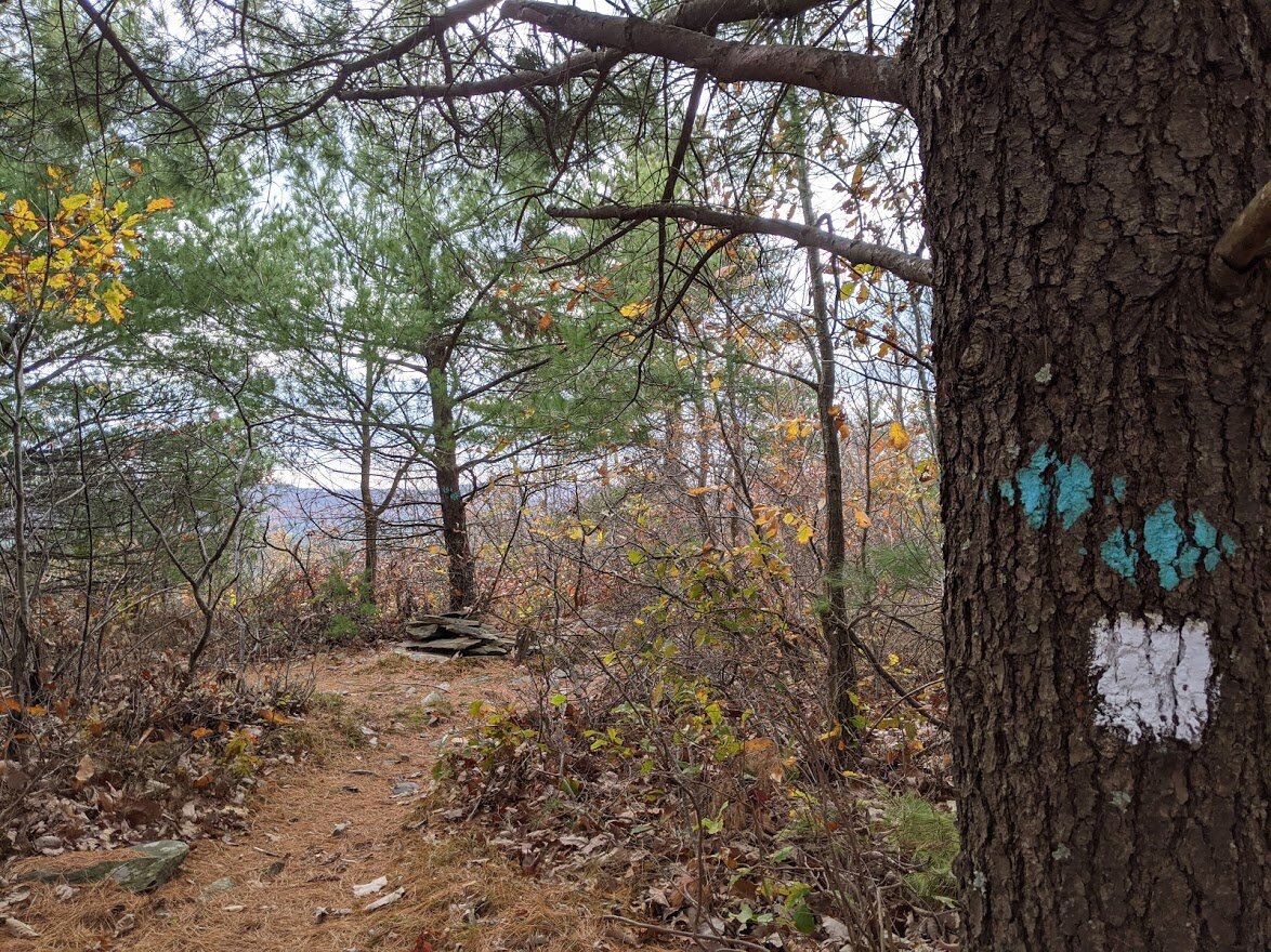
Though the sky was gloomy, nothing out here can dampen my spirits hiking through the unforgettable terrain of Hanks East.

FB: Step Away from the Day #2. Climbing up the spine of the mountain for a breezy, chilly ridge walk.

FB: Step Away from the Day, #3. The sun is shining...!!! ... for .025 seconds....

IG: Step Away from the Day, #3. The view is much more easily seen after the autumn leaves have dropped. Despite the grim sky, it is still beautiful.

Be it lichen or leaves, every colors and texture was dappled onto the landscape.

With the trees empty of foliage, it was easy to see the neighboring Kanouse Mountain to the east.

I had to just stand there with my face to the sun to soak it in. We hadn't had sun in nearly a week and this was a welcome joyful minute.

The sun lit up my world, and my heart.

And it kept trying to get through the clouds cover all day.

FB: Step Away from the Day, #4. There ain't no party like a ridge walk party!

FB: Step Away from the Day, #5. Well, party people... it's time to say goodbye to the high ridge line and walk down the steep descent of the Highlands Trail toward the lowland marsh

IG: Step Away from the Day, #4 Well, party people... it's time to say goodbye to the high ridge line and walk down the steep descent of the Highlands Trail toward the lowland marsh.

IG: Step Away from the Day, #5. I may or may not have accidentally done a split while climbing down this slippery outcropping. A split? The splits? Which one is grammatically correct?

FB: Step Away from the Day #6. This is a tiny marsh on the descent. The marshland is yet to come. I'm going to go out on a limb and say it's a good thing I brought an extra pair of socks!!!

IG: Step Away from the Day #6. This section of the Highlands Trail took a hot in the late summer storms, but the trail maintainers have performed a miracle!

FB: Step Away from the Day, #7 1.7 miles. 12 unique posts over 2 social media platforms. 1 roadside walk.

Sorry for the blurry quality of the foreground, but I like signs.

FB: Step Away from the Day, #8. Winter is coming.... ... so is the marsh.
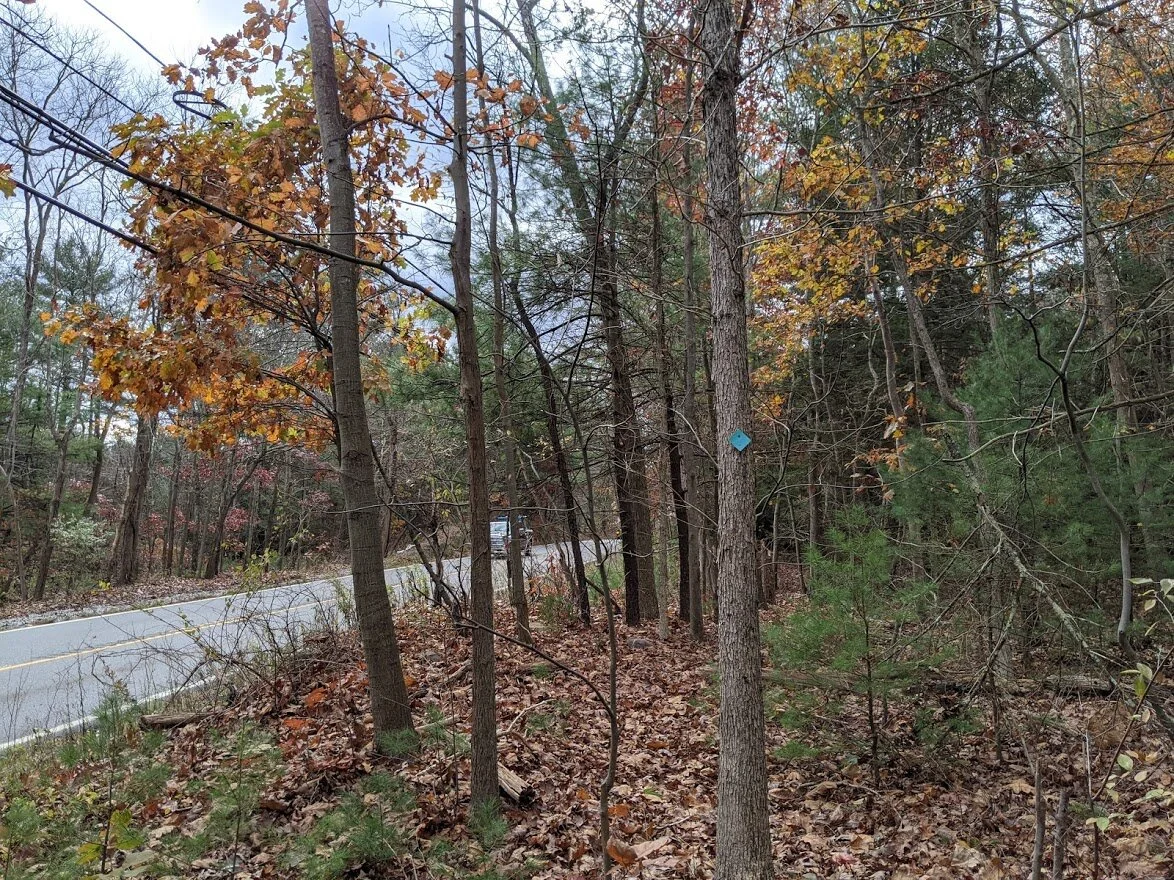
IG: Step Away from the Day, #7 Here is one more reason to love the Highlands Trail: the trail blazers put the road walk section in the woods! No needing nerves of steel with oncoming traffic barreling toward you! Thanks, Trail Blazers!!!

There was an alternate route that bypassed a good portion of road walking, which is good because there wasn't much shoulder for walking and the cars travel very fast down Macopin Road. This is looking in the direction of the alt rt.

This is looking in the direction of the Highlands Trail and the road walk.

I opted for the alt rt.

IG: Step Away from the Day, #8. Well... Maybe a few nerves of steel.

It's a short road walk from the alt route, and follow the markers for the best place to cross the road.

So, there is an entire section on Gould Road, and I thought it was going to be NEXT to the road through the marsh, but it was actually road walking, which spared my boots, socks and feet. Although I'm sure my waterproof Oboz would have kicked it!

Because lumber.

The walk beside Gould Road. I saw three cars and one motorcycle. It's not as busy nor as dangerous as Macopin Road.

Natures colors are still hanging in... even in November. Or... despite November...?

FB: Step Away from the Day, #9. Take that, marsh! I avoided you by traveling on Gould Road! (Not on FB: that pull off on the left is the parking area on Gould Rd. for the Highlands Trail. Not much. SPace for one or two cars)

More signage from the Watershed and the Highlands Trail org.

IG: Step Away from the Day, #9. Yep. That's the trail.

I trudged along slowly in this section because the leaf cover on the forest floor was really deep and very hard to see what rocks lie beneath.

IG: Step Away from the Day, #9 Halfway mark! Snack time! But I don't dare stay long. The wind has increased and the temperature has dropped. (Not on IG: hell yes I hashtagged Cheerios in this pic)

IG: Step Away from the Day, #10! The trail looks pretty but I've come to a crawl because the leaf cover on the forest floor is so dense, I can't see the small wobbly boulders or tree roots beneath.

Please tell me you can tell how deep the leaves are. I had to take a picture of them. It was like a sea of fall!

FB: Step Away from the Day, #10! Made it to the Wooley Road junction on the Highlands Trail!
IG: Step Away from the Day, #11 Echo Lake is just visible through the trees at 1000'.

FB: Step Away from the Day, #11 Echo Lake is easily viewed through the newly bare trees. Almost on the home stretch!

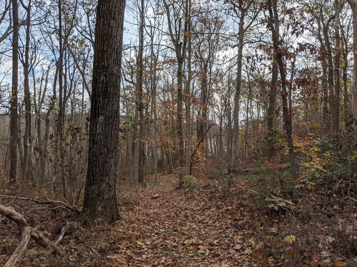
Step Away from the Day, #12 On another white blaze/teal blaze, but this time I'm on the west side of Echo Lake, rather than the high ridge of Bearfort Mountain.

The terrain on Echo Lake West is very different from Echo Lake East. It's much easier. This section of rock is the barrier between the trail and the edge of the water. Fewer scenic viewpoints, but a much flatter and cleaner trail.

Backlit incredi-colors
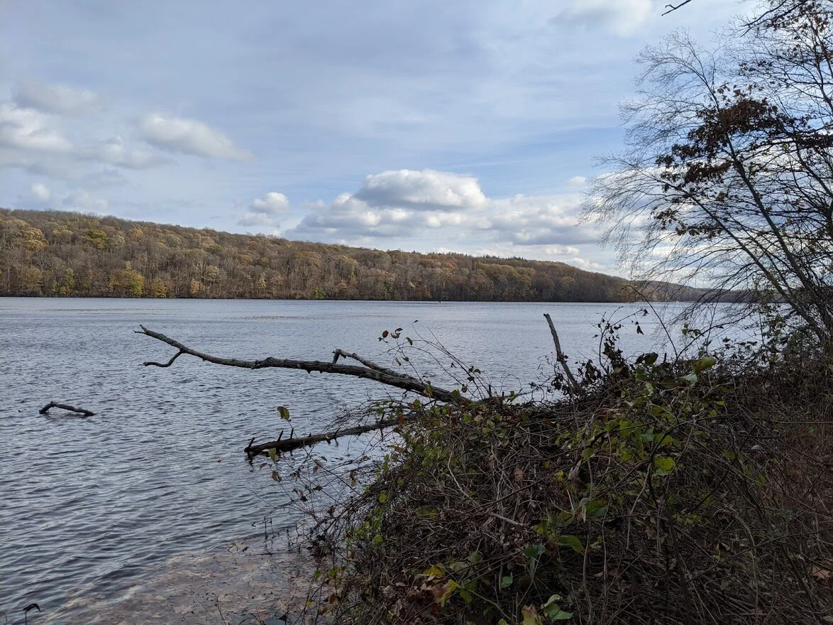
Echo Lake from it's western shores

FB: Step Away from the Day, #12. Doctor Wooblestone, I presume. (Jerk) 😂

Step Away from the Day, (lucky) #13 Remember the curious-human geology lesson at highlighthiker.com? This is what the western side of Echo Lake looks like by comparison. Keep in mind, these boulders are as tall as me!! https://www.highlighthiker.com/october-15-2020-really-far-east

Same spot as the previous photo, just looking in a southernly direction.

A friend of mine takes gorgeous photos of the reflections found in puddles and other still waters. I did a very bad job imitating her art. But it was pretty, so I wanted to show her what I saw.

Getting closer to the end of my journey and the sun finally came out for good!

Echo Lake west looking north

FB: Step Away from the Day, #13 Be more erratic!!!

There is natural stone walk out into Echo Lake. This is what you are rewarded with if you step out there.

FB & IG: Step Away from the Day, #14 My friends... it's the end of the line! This hike completes all marked trails in the Newark-Pequannock Watershed on NY/NJ Trail Conference map #116. I am only 2 hikes away from completing the entire map!! Stats: 6 miles (exactly) in 4:15, 0 blisters (of course, please), 28 unique posts over 2 social media platforms, 3 trails, 2 road walks, 1 squirrel sighting, countless bird sightings, 0 human sightings. Thank you for being part of this special event! Y'on your own for entertainment now! 😂

There is a small picnic table next to the two (really clean) porta johns behind the watershed office. Not a bad view!

IG: What every hiker deserves after a day exploring the woods: a warm, roaring campfire!